|
search place name
|
||
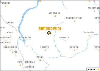
Ban Phae Doi (Mae Hong Son, Thailand)Ban Phae Doi is a town in the Mae Hong Son region of Thailand. An overview map of the region around Ban Phae Doi is displayed below.
regional and 3d topo map of Ban Phae Doi, Thailand ::
Ban Phae Doi airports ::
The nearest airport is LPT - Lampang, located 188.0 km east of Ban Phae Doi.
Other airports nearby include RGN - Yangon Intl (204.0 km south west), Nearby towns ::
Ban Klo Kho (5.8km south) //
Ban Luang (5.8km south) //
Ban Re To (5.8km south) //
Ban Thi I Lu (5.6km east) //
Ban Ko Se Lo (7.6km north) //
[all distances 'as the bird flies' and approximate]  Places with similar names to Ban Phae Doi, Thailand ::
// Beni Fouda (MA)
// Benefit (US)
// Benfeita (PT)
// Ban Ao Fat (TH)
// Ban A Phat (TH)
// Ban Aphut (TH)
// Ban Fit (TH)
// Ban Na Phaet (TH)
// Ban Pha Di (TH)
// Ban Pha Dui (TH)
Disclaimer :: Information on this page comes without warranty of any kind |
||
|
Where is Ban Phae Doi? Elevation and coordinates ::
Latitude (lat): 17°51'0"N Longitude (lon): 97°47'0"E
Elevation (approx.): 263m (map arrows pan, magnifying glasses zoom) |
||
|
Visiting Ban Phae Doi? Hotel/Accommodation ::
Book a hotel in Ban Phae Doi Travel Guide ::
Buy a travel guide for Thailand rental cars ::
car rental offers GPS waypoint ::
download a GPX waypoint (PoI) of Ban Phae Doi for your GPS receiver
|
||