|
search place name
|
||
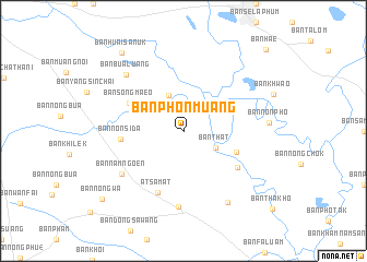
Ban Phon Muang (Roi Et, Thailand)Ban Phon Muang is a town in the Roi Et region of Thailand. An overview map of the region around Ban Phon Muang is displayed below.
regional and 3d topo map of Ban Phon Muang, Thailand ::
Ban Phon Muang airports ::
The nearest airport is ZVK - Savannakhet, located 117.4 km north east of Ban Phon Muang.
Other airports nearby include SNO - Sakon Nakhon (143.7 km north), UTH - Udon Thani (200.3 km north west), PKZ - Pakse (221.4 km south east), NAK - Nakhon Ratchasima Khorat (222.1 km south west), Nearby towns ::
Ban That (3.6km south east) //
Ban Nang Loeng (3.7km north east) //
Ban I Kom (3.9km north) //
Ban Nam Thiang (5.7km south east) //
Ban Song Maeo (6.0km north west) //
Ban Non Sida (6.2km west) //
Ban Chi Lon (6.5km south east) //
At Samat (6.8km south) //
Ban Nam Ngoen (7.5km south west) //
Ban Chu Chat (7.8km south) //
Ban Bua Luang (8.1km north west) //
Ban Kut Khieo (8.6km south east) //
Ban Non Pho (8.4km east) //
Ban Huai Sanuk (10.0km north west) //
Ban Nong Wa (10.6km south west) //
Ban Hae (11.6km north east) //
[all distances 'as the bird flies' and approximate]  Places with similar names to Ban Phon Muang, Thailand ::
// Ban Phon Muang (TH)
// Ban Phon Muang (TH)
// Ban Phon Muang (TH)
// Ban Phon Muang (TH)
// Ban Phon Muang (TH)
// Ban Phônméng (LA)
// Ban Phônmouang (LA)
// Ban Phônmouang (LA)
// Ban Phônmouang (LA)
// Ban Phônmouang (LA)
Disclaimer :: Information on this page comes without warranty of any kind |
||
|
Where is Ban Phon Muang? Elevation and coordinates ::
Latitude (lat): 15°55'0"N Longitude (lon): 103°53'0"E
Elevation (approx.): 143m (map arrows pan, magnifying glasses zoom) |
||
|
Visiting Ban Phon Muang? Hotel/Accommodation ::
Book a hotel in Ban Phon Muang Travel Guide ::
Buy a travel guide for Thailand rental cars ::
car rental offers GPS waypoint ::
download a GPX waypoint (PoI) of Ban Phon Muang for your GPS receiver
|
||