|
search place name
|
||
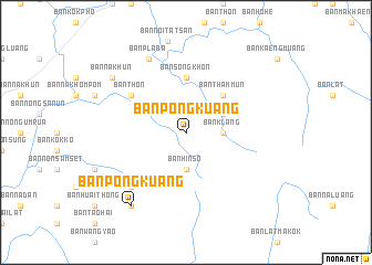
Ban Pong Kuang (Loei, Thailand)Ban Pong Kuang is a town in the Loei region of Thailand. An overview map of the region around Ban Pong Kuang is displayed below.
regional and 3d topo map of Ban Pong Kuang, Thailand ::
Ban Pong Kuang airports ::
The nearest airport is LOE - Loei, located 36.8 km east of Ban Pong Kuang.
Other airports nearby include PHS - Phitsanulok (133.1 km south west), VTE - Vientiane Wattay Intl (144.1 km north east), UTH - Udon Thani (147.8 km east), PRH - Phrae (159.1 km north west), Nearby towns ::
Ban Klang (3.5km east) //
Ban Hin So (3.7km south) //
Ban Nam Thom (4.0km north east) //
Ban San Tom (5.1km north east) //
Ban Tham Mun (5.1km north east) //
Ban Kaeng Muang (5.1km north east) //
Ban Makhaeng (5.1km north east) //
Ban Song Khon (5.6km north) //
Ban Thon (6.5km north west) //
Ban Kaeng (6.5km north west) //
Ban Pla Ba (6.5km north west) //
Ban Song Khon (6.5km north west) //
Ban Bong (6.5km north west) //
Ban Na Lan Khao (7.7km south west) //
Ban Pla Ba (8.2km north west) //
Ban Na Khun (9.0km north west) //
Ban Pong Kuang (9.1km south west) //
Ban Klang (9.1km south west) //
Ban Hin So (9.1km south west) //
[all distances 'as the bird flies' and approximate] 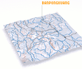 Places with similar names to Ban Pong Kuang, Thailand ::
// Ban Pang Kiang (TH)
// Ban Pang Kung (TH)
// Ban Pong Kuang (TH)
// Ban Poung Kèng (LA)
// Bản Piềng Kuòng (VN)
Disclaimer :: Information on this page comes without warranty of any kind |
||
|
Where is Ban Pong Kuang? Elevation and coordinates ::
Latitude (lat): 17°19'0"N Longitude (lon): 101°24'0"E
Elevation (approx.): 970m (map arrows pan, magnifying glasses zoom) |
||
|
Visiting Ban Pong Kuang? Hotel/Accommodation ::
Book a hotel in Ban Pong Kuang Travel Guide ::
Buy a travel guide for Thailand rental cars ::
car rental offers GPS waypoint ::
download a GPX waypoint (PoI) of Ban Pong Kuang for your GPS receiver
|
||