|
search place name
|
||
Ban Pu Rong (Yala, Thailand)Ban Pu Rong is a town in the Yala region of Thailand. An overview map of the region around Ban Pu Rong is displayed below.
regional and 3d topo map of Ban Pu Rong, Thailand ::

Ban Pu Rong airports ::
The nearest airport is PAN - Pattani, located 38.2 km north of Ban Pu Rong.
Other airports nearby include NAW - Narathiwat (56.2 km east), AOR - Alor Setar Sultan Abdul Halim (97.5 km west), HDY - Songkhla Hat Yai Intl (107.7 km north west), KBR - Kota Bahru Sultan Ismail Petra (120.7 km east), Nearby towns ::
Ban Kubae Rayo (0.7km west) //
Kampong Pinang (1.9km north) //
Ban Muang Wan (2.1km north east) //
Ban Pong Kayi (3.0km east) //
Kampong Pinang (3.7km north) //
Ben Ka Noi (3.7km east) //
Kampong Lubokalo (3.9km south) //
Kampong Kuyae (3.9km south) //
Kota Baru (4.0km south) //
Ban Ba Tu Bu La (4.1km south west) //
Ban Yu Ki (4.7km south east) //
Kampong Kanyi (4.8km east) //
Ban Ku Bae Ra Yo (5.3km north west) //
Changwat Yala (5.6km north) //
Ban Khanong (5.7km north west) //
Kampong Dayae (5.8km south) //
Ban Krong Pinang (6.2km south east) //
Ban Ba Lo Ba Ta (6.9km south west) //
Kampong Rube (7.5km south east) //
Ban La Ae (7.5km west) //
Ban Po Song (7.6km north west) //
Ban Na Tham (8.5km north west) //
Ban Niang (8.5km north west) //
Ban Chu Nae Lae (8.8km north east) //
Ban Ko Ta Ba Ru (8.8km east) //
Ban Ra No (9.2km south east) //
Ban Kawe (9.2km north east) //
Ban Niang (9.8km north west) //
Kampong Lu (9.9km south west) //
[all distances 'as the bird flies' and approximate] 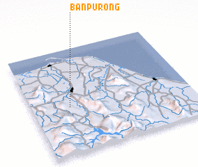 Places with similar names to Ban Pu Rong, Thailand ::
// Ban Na Prang (TH)
// Ban Pa Rang (TH)
// Ban Pra-ang (TH)
// Ban Prang (TH)
// Ban Prang (TH)
// Ban Prang (TH)
// Ban Priang (TH)
// Ban Priang (TH)
// Ban Pring (TH)
// Ban Prong (TH)
Disclaimer :: Information on this page comes without warranty of any kind |
||
|
Where is Ban Pu Rong? Elevation and coordinates ::
Latitude (lat): 6°27'4"N Longitude (lon): 101°14'23"E
Elevation (approx.): 38m (map arrows pan, magnifying glasses zoom) |
||
|
Visiting Ban Pu Rong? Hotel/Accommodation ::
Book a hotel in Ban Pu Rong Travel Guide ::
Buy a travel guide for Thailand rental cars ::
car rental offers GPS waypoint ::
download a GPX waypoint (PoI) of Ban Pu Rong for your GPS receiver
|
||