|
search place name
|
||
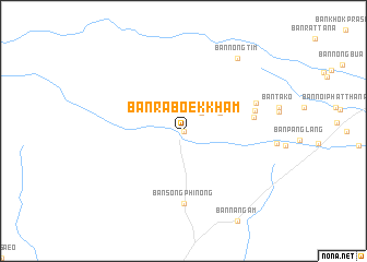
Ban Raboek Kham (Prachin Buri, Thailand)Ban Raboek Kham is a town in the Prachin Buri region of Thailand. An overview map of the region around Ban Raboek Kham is displayed below.
regional and 3d topo map of Ban Raboek Kham, Thailand ::
Ban Raboek Kham airports ::
The nearest airport is NAK - Nakhon Ratchasima Khorat, located 120.7 km north west of Ban Raboek Kham.
Other airports nearby include REP - Siem-reap Siem Reap (139.4 km south east), UTP - Rayong U Taphao Intl (234.4 km south west), Nearby towns ::
Ban Raboet Kham (0.0km north) //
Ban Phrai (2.6km north east) //
Ban Khok Makha (4.0km north east) //
Ban Pa Song (7.1km east) //
Ban Song Phi Nong (7.4km south) //
Ban Kut Wian (7.4km east) //
Ban Nuea (7.7km east) //
Ban Nong Tim (9.2km north east) //
[all distances 'as the bird flies' and approximate] 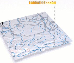 Places with similar names to Ban Raboek Kham, Thailand ::
// Ban Raboek Kham (TH)
Disclaimer :: Information on this page comes without warranty of any kind |
||
|
Where is Ban Raboek Kham? Elevation and coordinates ::
Latitude (lat): 14°1'0"N Longitude (lon): 102°41'0"E
Elevation (approx.): 93m (map arrows pan, magnifying glasses zoom) |
||
|
Visiting Ban Raboek Kham? Hotel/Accommodation ::
Book a hotel in Ban Raboek Kham Travel Guide ::
Buy a travel guide for Thailand rental cars ::
car rental offers GPS waypoint ::
download a GPX waypoint (PoI) of Ban Raboek Kham for your GPS receiver
|
||