|
search place name
|
||
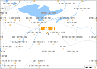
Ban Rai (1) (Nakhon Sawan, Thailand)Ban Rai (1) is a town in the Nakhon Sawan region of Thailand. An overview map of the region around Ban Rai (1) is displayed below.
regional and 3d topo map of Ban Rai (1), Thailand ::
Ban Rai (1) airports ::
The nearest airport is PHS - Phitsanulok, located 129.1 km north of Ban Rai (1).
Other airports nearby include BKK - Bangkok Intl (191.7 km south), NAK - Nakhon Ratchasima Khorat (207.1 km east), LOE - Loei (253.5 km north east), Nearby towns ::
Ban Hua Khrak (1.9km north) //
Ban Hua Phluang (3.6km east) //
Ban Pra Non (4.0km north west) //
Ban Phu Noi (4.1km south east) //
Ban Hua Dong Phra Non (1) (5.1km north west) //
Ban Noen Samran (5.1km north west) //
Ban Nong Tao (5.1km south west) //
Ban Nong Khanak (5.4km west) //
Ban Tha Khwai Noi (5.8km north) //
Ban Noen Rakhang (7.4km north) //
Ban Tha Din Daeng (7.4km north) //
Ban Khao Wiwat (7.4km south) //
Ban Rai (7.7km south east) //
Ban Rai (9.0km north west) //
Ban Pak Ngam Tai (9.0km north east) //
[all distances 'as the bird flies' and approximate] 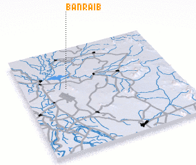 Places with similar names to Ban Rai (1), Thailand ::
// Ban Na Rua (1) (TH)
// Ban Rai (1) (TH)
// Ban Rai (1) (TH)
// Ban Rai (1) (TH)
// Ban Rai (1) (TH)
// Ban Rai (1) (TH)
// Ban Rai (1) (TH)
// Ban Rai (1) (TH)
// Benarrabá (ES)
// Binrāba (BD)
Disclaimer :: Information on this page comes without warranty of any kind |
||
|
Where is Ban Rai (1)? Elevation and coordinates ::
Latitude (lat): 15°37'0"N Longitude (lon): 100°17'0"E
Elevation (approx.): 50m (map arrows pan, magnifying glasses zoom) |
||
|
Visiting Ban Rai (1)? Hotel/Accommodation ::
Book a hotel in Ban Rai (1) Travel Guide ::
Buy a travel guide for Thailand rental cars ::
car rental offers GPS waypoint ::
download a GPX waypoint (PoI) of Ban Rai (1) for your GPS receiver
|
||