|
search place name
|
||
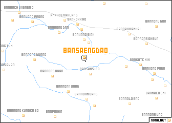
Ban Saeng Dao (Nong Bua Lamphu, Thailand)Ban Saeng Dao is a town in the Nong Bua Lamphu region of Thailand. An overview map of the region around Ban Saeng Dao is displayed below.
regional and 3d topo map of Ban Saeng Dao, Thailand ::
Ban Saeng Dao airports ::
The nearest airport is LOE - Loei, located 58.0 km north west of Ban Saeng Dao.
Other airports nearby include UTH - Udon Thani (62.8 km east), VTE - Vientiane Wattay Intl (91.7 km north east), SNO - Sakon Nakhon (201.8 km east), PHS - Phitsanulok (212.6 km west), Nearby towns ::
Ban Kan (2.1km north east) //
Ban Sam Sieo (2.8km south) //
Ban Fang Daeng (4.2km north) //
Ban Non Tan (4.4km north east) //
Ban Wang Siam (4.7km north) //
Na Klang (7.0km north) //
Ban Non Muang (7.5km south west) //
Ban Non Sawan (7.7km south west) //
Ban Non Muang (8.2km south) //
Ban Kok Kho (8.3km north) //
Ban Nong Dan (8.5km north west) //
Ban Hin Lap (8.5km east) //
[all distances 'as the bird flies' and approximate] 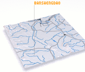 Places with similar names to Ban Saeng Dao, Thailand ::
// Ban Saeng Dao (TH)
// Ban Song Tao (TH)
// Ban Sang-At (LA)
// Ban Sangdua (LA)
// Ban Sèngdi (LA)
// Ban Sing-Tai (LA)
// Bản Siêng Tẩu (VN)
// Bản Sung Tay (VN)
Disclaimer :: Information on this page comes without warranty of any kind |
||
|
Where is Ban Saeng Dao? Elevation and coordinates ::
Latitude (lat): 17°13'37"N Longitude (lon): 102°13'17"E
Elevation (approx.): 251m (map arrows pan, magnifying glasses zoom) |
||
|
Visiting Ban Saeng Dao? Hotel/Accommodation ::
Book a hotel in Ban Saeng Dao Travel Guide ::
Buy a travel guide for Thailand rental cars ::
car rental offers GPS waypoint ::
download a GPX waypoint (PoI) of Ban Saeng Dao for your GPS receiver
|
||