|
search place name
|
||
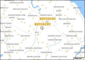
Ban Sa Kam (Pattani, Thailand)Ban Sa Kam is a town in the Pattani region of Thailand. An overview map of the region around Ban Sa Kam is displayed below.
regional and 3d topo map of Ban Sa Kam, Thailand ::
Ban Sa Kam airports ::
The nearest airport is PAN - Pattani, located 31.5 km west of Ban Sa Kam.
Other airports nearby include NAW - Narathiwat (41.6 km south east), KBR - Kota Bahru Sultan Ismail Petra (113.9 km south east), HDY - Songkhla Hat Yai Intl (117.1 km west), AOR - Alor Setar Sultan Abdul Halim (129.3 km south west), Nearby towns ::
Kampong Mayo (2.6km south west) //
Ma Yo (3.2km south west) //
Ban Sakam (3.4km north east) //
Ban Don (3.7km north) //
Amphoe Pa Na Re (3.7km north) //
Ban Thanoa (3.9km west) //
Kampong Rawo (4.1km north east) //
Ban Ba Lu Ka Tu Ngo (4.5km south west) //
Ban Pa Ta Ku Bo (5.6km south) //
Ban To Ti Te (5.7km north) //
Kampong Luboyirai (5.9km south) //
Kampong Kraso (5.8km west) //
Kampong Baloi (5.9km north) //
Ban Ko Chan (6.1km west) //
Ban Pa Maphrao (6.6km south) //
Kampong To Chut (6.7km south east) //
Ban Khlong (6.7km north east) //
Ban Ba Kong (6.8km north west) //
Kampong Bayo (7.6km south) //
Kampong Batapa (7.8km south east) //
Ban Tam Ma Su (7.9km north) //
Ban Tarang (8.2km south west) //
Ban Sama Ho (8.6km west) //
Ban Bo Muang (2) (9.2km north west) //
Ban Don (9.2km north east) //
Ban Ko To (9.4km south west) //
Ban Ko (10.4km north east) //
Ban Cha Mu Kha (11.4km south east) //
[all distances 'as the bird flies' and approximate] 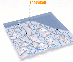 Places with similar names to Ban Sa Kam, Thailand ::
// Ban Sakam (TH)
// Ban Sok Kam (TH)
// Ban Sok Kam (TH)
// Ban Sok Mai (TH)
// Ban Sok Mai (TH)
// Banza-Kombe (CD)
// Bản Suối Kim (VN)
// Banza Comba (AO)
// Banza Gombe (AO)
Disclaimer :: Information on this page comes without warranty of any kind |
||
|
Where is Ban Sa Kam? Elevation and coordinates ::
Latitude (lat): 6°44'0"N Longitude (lon): 101°26'0"E
Elevation (approx.): 46m (map arrows pan, magnifying glasses zoom) |
||
|
Visiting Ban Sa Kam? Hotel/Accommodation ::
Book a hotel in Ban Sa Kam Travel Guide ::
Buy a travel guide for Thailand rental cars ::
car rental offers GPS waypoint ::
download a GPX waypoint (PoI) of Ban Sa Kam for your GPS receiver
|
||