|
search place name
|
||
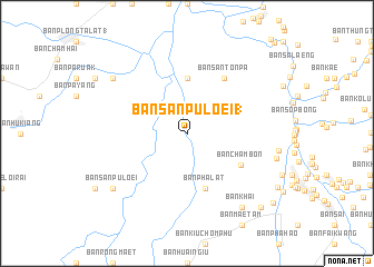
Ban San Pu Loei (1) (Chiang Rai, Thailand)Ban San Pu Loei (1) is a town in the Chiang Rai region of Thailand. An overview map of the region around Ban San Pu Loei (1) is displayed below.
regional and 3d topo map of Ban San Pu Loei (1), Thailand ::
Ban San Pu Loei (1) airports ::
The nearest airport is THL - Tachilek Tachileik, located 105.2 km north of Ban San Pu Loei (1).
Other airports nearby include MOG - Mong Hsat (144.2 km north west), PRH - Phrae (158.8 km south), LPT - Lampang (161.1 km south west), KET - Kengtung (200.9 km north), Nearby towns ::
Ban Rong Chae (5.6km north) //
Ban Pha Lat (5.8km south) //
Ban Cham Bon (6.0km south east) //
Ban Ngao (6.6km north east) //
Ban San Ton Pa (6.6km north east) //
Ban Pi (6.6km north east) //
Ban Ian (6.6km north east) //
Ban Khai (9.1km south east) //
Amphoe Thoeng (8.9km north west) //
Ban San Pu Loei (8.9km south west) //
Ban Waen (10.2km south east) //
Ban Phaet (10.7km south east) //
[all distances 'as the bird flies' and approximate] 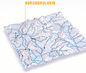 Places with similar names to Ban San Pu Loei (1), Thailand ::
Disclaimer :: Information on this page comes without warranty of any kind |
||
|
Where is Ban San Pu Loei (1)? Elevation and coordinates ::
Latitude (lat): 19°34'0"N Longitude (lon): 100°12'0"E
Elevation (approx.): 370m (map arrows pan, magnifying glasses zoom) |
||
|
Visiting Ban San Pu Loei (1)? Hotel/Accommodation ::
Book a hotel in Ban San Pu Loei (1) Travel Guide ::
Buy a travel guide for Thailand rental cars ::
car rental offers GPS waypoint ::
download a GPX waypoint (PoI) of Ban San Pu Loei (1) for your GPS receiver
|
||