|
search place name
|
||
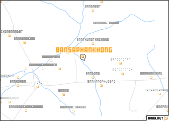
Ban Saphan Khong (Lop Buri, Thailand)Ban Saphan Khong is a town in the Lop Buri region of Thailand. An overview map of the region around Ban Saphan Khong is displayed below.
regional and 3d topo map of Ban Saphan Khong, Thailand ::
Ban Saphan Khong airports ::
The nearest airport is BKK - Bangkok Intl, located 135.1 km south of Ban Saphan Khong.
Other airports nearby include NAK - Nakhon Ratchasima Khorat (137.2 km east), PHS - Phitsanulok (193.2 km north), Nearby towns ::
Ban Thung Tha Chang (4.1km north east) //
Ban Dong (4.1km south east) //
Ban Huai Yai (4.0km north west) //
Ban Nong Samrong (5.7km west) //
Ban Wang Phloeng (6.6km south east) //
Ban Na Phra (7.2km west) //
Ban Dong Nam (7.7km east) //
Ban Dong Ta Khao (8.7km north east) //
Ban Noi (8.8km south west) //
Ban Dong Nam (8.7km east) //
[all distances 'as the bird flies' and approximate] 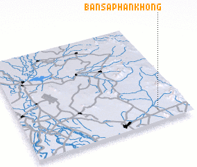 Places with similar names to Ban Saphan Khong, Thailand :: Disclaimer :: Information on this page comes without warranty of any kind |
||
|
Where is Ban Saphan Khong? Elevation and coordinates ::
Latitude (lat): 15°7'0"N Longitude (lon): 100°49'0"E
Elevation (approx.): 47m (map arrows pan, magnifying glasses zoom) |
||
|
Visiting Ban Saphan Khong? Hotel/Accommodation ::
Book a hotel in Ban Saphan Khong Travel Guide ::
Buy a travel guide for Thailand rental cars ::
car rental offers GPS waypoint ::
download a GPX waypoint (PoI) of Ban Saphan Khong for your GPS receiver
|
||