|
search place name
|
||
Ban Sarong Phong Na Ko (Pattani, Thailand)Ban Sarong Phong Na Ko is a town in the Pattani region of Thailand. An overview map of the region around Ban Sarong Phong Na Ko is displayed below.
regional and 3d topo map of Ban Sarong Phong Na Ko, Thailand ::

Ban Sarong Phong Na Ko airports ::
The nearest airport is PAN - Pattani, located 28.1 km north west of Ban Sarong Phong Na Ko.
Other airports nearby include NAW - Narathiwat (45.4 km east), HDY - Songkhla Hat Yai Intl (110.8 km west), AOR - Alor Setar Sultan Abdul Halim (115.0 km south west), KBR - Kota Bahru Sultan Ismail Petra (116.2 km south east), Nearby towns ::
Thung Yang Daeng (2.9km north west) //
Ban Bu Ko Ba Tu (4.3km west) //
Kampong Buketabe (4.6km south east) //
Ban Ko Ba To (4.7km west) //
Ban Bu Don (4.7km north) //
Ban Khao Tum (4.9km west) //
Kampong Rabo (5.0km south west) //
Ban Ku Chu (5.0km south) //
Ban Bo Khan (5.2km west) //
Ban Mai Kaen (5.8km south) //
Ban Nam Sai (6.0km north east) //
Ban Pa Lu Ka Lu Wa (6.1km east) //
Ban Muang Mang (6.2km north west) //
Ban Ta Lo Ni Bong (6.3km south east) //
Ban Sarong (6.3km south west) //
Kampong Lukachaeli (7.0km north east) //
Amphoe Mayo (7.2km north) //
Kampong Pado (7.2km north) //
Ban Mo Ma Wi (7.3km north west) //
Kampong Ma Mawi (7.3km north west) //
Ban Khok Mai Phai (7.9km east) //
Ban Ko To (8.5km north) //
Ban Ba Do (9.2km south west) //
Kampong Madong (9.5km south west) //
Ban Khlong Tong (9.9km north west) //
Kampong Luboyirai (10.7km north east) //
Mae Lan (10.7km north west) //
Yala (10.8km south west) //
Ban Sa Mo (11.1km south east) //
[all distances 'as the bird flies' and approximate] 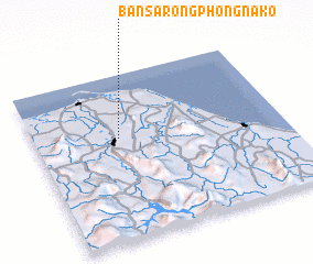 Places with similar names to Ban Sarong Phong Na Ko, Thailand :: Disclaimer :: Information on this page comes without warranty of any kind |
||
|
Where is Ban Sarong Phong Na Ko? Elevation and coordinates ::
Latitude (lat): 6°37'7"N Longitude (lon): 101°20'41"E
Elevation (approx.): 25m (map arrows pan, magnifying glasses zoom) |
||
|
Visiting Ban Sarong Phong Na Ko? Hotel/Accommodation ::
Book a hotel in Ban Sarong Phong Na Ko Travel Guide ::
Buy a travel guide for Thailand rental cars ::
car rental offers GPS waypoint ::
download a GPX waypoint (PoI) of Ban Sarong Phong Na Ko for your GPS receiver
|
||