|
search place name
|
||
Ban Sisiat (Chanthaburi, Thailand)Ban Sisiat is a town in the Chanthaburi region of Thailand. An overview map of the region around Ban Sisiat is displayed below.
regional and 3d topo map of Ban Sisiat, Thailand ::

Ban Sisiat airports ::
The nearest airport is UTP - Rayong U Taphao Intl, located 140.8 km west of Ban Sisiat.
Other airports nearby include REP - Siem-reap Siem Reap (185.3 km north east), BKK - Bangkok Intl (231.7 km north west), Nearby towns ::
Ban Tok Phrom (2.6km south east) //
Ban Nong Pla Lai (3.7km south) //
Ban Ang Et (4.1km south east) //
Ban Welu Lang (4.1km north west) //
Ban Kalumphuk (5.6km south) //
Ban Welu Klang (5.8km north) //
Ban Rai Pa (6.6km south west) //
Ban Map Phai (6.6km south west) //
Ban Makok (6.6km south west) //
Ban Thung Yao (6.6km south east) //
Ban Nong Wa (7.4km south) //
Ban Don (7.6km south) //
Ban Sato Noi (7.5km east) //
Ban Thung Bon (7.8km north west) //
Ban Bo I Rem (7.8km south east) //
Ban Bo I Rem (7.8km south east) //
Ban Sato Wang Cham (8.1km south east) //
Ban Patthawi (10.4km north west) //
Ban Noen Klaeng (10.4km north west) //
[all distances 'as the bird flies' and approximate] 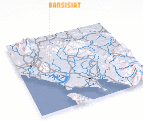 Places with similar names to Ban Sisiat, Thailand ::
Disclaimer :: Information on this page comes without warranty of any kind |
||
|
Where is Ban Sisiat? Elevation and coordinates ::
Latitude (lat): 12°38'0"N Longitude (lon): 102°18'0"E
Elevation (approx.): 24m (map arrows pan, magnifying glasses zoom) |
||
|
Visiting Ban Sisiat? Hotel/Accommodation ::
Book a hotel in Ban Sisiat Travel Guide ::
Buy a travel guide for Thailand rental cars ::
car rental offers GPS waypoint ::
download a GPX waypoint (PoI) of Ban Sisiat for your GPS receiver
|
||