|
search place name
|
||
Ban Sop Kaen (Nan, Thailand)Ban Sop Kaen is a town in the Nan region of Thailand. An overview map of the region around Ban Sop Kaen is displayed below.
regional and 3d topo map of Ban Sop Kaen, Thailand ::

Ban Sop Kaen airports ::
The nearest airport is PRH - Phrae, located 90.7 km south west of Ban Sop Kaen.
Other airports nearby include LPT - Lampang (142.2 km west), LOE - Loei (173.8 km south east), LPQ - Luang Prabang Luang Phabang Intl (196.4 km north east), VTE - Vientiane Wattay Intl (206.3 km south east), Nearby towns ::
Ban Du Tai (3) (0.0km north) //
Ban Chiang Rai (0.0km north) //
Ban Tha Nao (1.9km north) //
Ban Thong Noi (1) (1.8km west) //
Ban Kong Khwai (1.9km south) //
Ban Du Nua (1) (3.7km north) //
Ban Samun (3.7km north) //
Ban Nam Khrok Mai (3.7km south) //
Ban Nong Tao (4.1km north east) //
Ban Nong (2) (5.1km north east) //
Ban Sao (5.3km west) //
Ban Nam Kaen Tai (1) (5.6km east) //
Ban Pang Chai (6.6km north east) //
Ban Fai Kaeo (6.6km north east) //
Ban Pua Chai (6.6km north east) //
Ban Si Koet (1) (6.4km north west) //
Ban Na Luang (6.4km south east) //
Ban Ta Kaeo (6.6km north west) //
Ban Kaeo Ta (6.6km north west) //
Nan (7.6km north) //
Ban Chae Phang (1) (7.3km east) //
Ban Nam Kian Tai (7.3km east) //
Ban Na Tho (7.6km north) //
Changwat Nan (7.3km west) //
Ban Na Sao (7.3km west) //
Ban Samun (7.3km west) //
Ban Du Tai (7.3km west) //
Ban Nam Song (7.6km south) //
Ban Khia (7.7km north west) //
[all distances 'as the bird flies' and approximate] 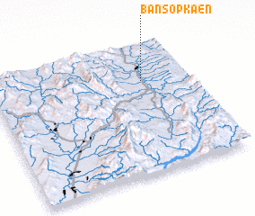 Places with similar names to Ban Sop Kaen, Thailand ::
// Ban Sop Kon (TH)
// Ban Sop Kon (TH)
// Ban Sôpkan (LA)
// Ban Sop Kouan (LA)
// Ban Sopkun (LA)
// Ban Spakan (LA)
// Bản Sop Kun (VN)
Disclaimer :: Information on this page comes without warranty of any kind |
||
|
Where is Ban Sop Kaen? Elevation and coordinates ::
Latitude (lat): 18°43'0"N Longitude (lon): 100°46'0"E
Elevation (approx.): 200m (map arrows pan, magnifying glasses zoom) |
||
|
Visiting Ban Sop Kaen? Hotel/Accommodation ::
Book a hotel in Ban Sop Kaen Travel Guide ::
Buy a travel guide for Thailand rental cars ::
car rental offers GPS waypoint ::
download a GPX waypoint (PoI) of Ban Sop Kaen for your GPS receiver
|
||