|
search place name
|
||
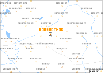
Ban Sua Thao (Maha Sarakham, Thailand)Ban Sua Thao is a town in the Maha Sarakham region of Thailand. An overview map of the region around Ban Sua Thao is displayed below.
regional and 3d topo map of Ban Sua Thao, Thailand ::
Ban Sua Thao airports ::
The nearest airport is UTH - Udon Thani, located 106.0 km north of Ban Sua Thao.
Other airports nearby include SNO - Sakon Nakhon (138.1 km north east), VTE - Vientiane Wattay Intl (176.7 km north), LOE - Loei (179.1 km north west), ZVK - Savannakhet (181.0 km east), Nearby towns ::
Ban Non Sung (1.8km east) //
Ban Nong Sua Thao (3.6km west) //
Ban Bo Yai (4.1km north west) //
Ban Nong Saphang (4.1km south west) //
Ban Nong Kung (5.6km east) //
Ban Non Ngiu (5.6km east) //
Chiang Yun (6.6km south east) //
Ban Kranuan (7.4km north) //
Ban Khu (7.7km north west) //
Ban Lup Saeng (8.2km north east) //
Ban Kham Pia (8.0km south west) //
Ban Chot (9.0km south west) //
[all distances 'as the bird flies' and approximate] 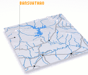 Places with similar names to Ban Sua Thao, Thailand ::
// Bone South (PH)
// Ban Sai Thai (TH)
// Ban Sai Thua (TH)
// Ban Sai Thua (TH)
// Ban Satho (TH)
// Ban Sathoi (TH)
// Ban Sathu (TH)
// Ban Si Tha (TH)
// Ban Si Thoi (TH)
// Ban Nasathô (LA)
Disclaimer :: Information on this page comes without warranty of any kind |
||
|
Where is Ban Sua Thao? Elevation and coordinates ::
Latitude (lat): 16°28'0"N Longitude (lon): 103°4'0"E
Elevation (approx.): 168m (map arrows pan, magnifying glasses zoom) |
||
|
Visiting Ban Sua Thao? Hotel/Accommodation ::
Book a hotel in Ban Sua Thao Travel Guide ::
Buy a travel guide for Thailand rental cars ::
car rental offers GPS waypoint ::
download a GPX waypoint (PoI) of Ban Sua Thao for your GPS receiver
|
||