|
search place name
|
||
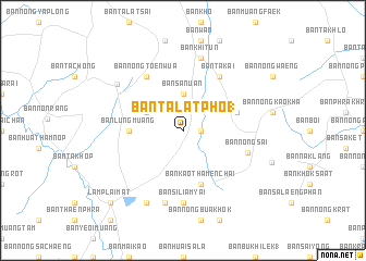
Ban Talat Pho (1) (Buriram, Thailand)Ban Talat Pho (1) is a town in the Buriram region of Thailand. An overview map of the region around Ban Talat Pho (1) is displayed below.
regional and 3d topo map of Ban Talat Pho (1), Thailand ::
Ban Talat Pho (1) airports ::
The nearest airport is NAK - Nakhon Ratchasima Khorat, located 89.9 km west of Ban Talat Pho (1).
Other airports nearby include REP - Siem-reap Siem Reap (209.7 km south east), ZVK - Savannakhet (257.4 km north east), Nearby towns ::
Ban Prasat (1.8km east) //
Ban Sanuan (3.7km north) //
Ban Nong Kha Yang (4.0km north west) //
Ban Lung Muang (5.4km west) //
Ban Kao Thamen Chai (5.8km south) //
Ban Bu Pho (5.7km east) //
Ban Takai (6.6km north east) //
Ban Nong Toen Wua (6.6km north west) //
Ban Nong Sai (6.8km east) //
Ban Si Liam Yai (7.4km south) //
Ban Sa Tako (7.6km south) //
Ban Khi Tun (7.6km north) //
Ban Phak Kat Ya (One) (8.0km north west) //
Ban Mai Bu Ta Wong (1) (8.2km south west) //
Lam Plai Mat (10.3km south west) //
Ban Phak Kat Ya (10.3km south west) //
[all distances 'as the bird flies' and approximate]  Places with similar names to Ban Talat Pho (1), Thailand :: Disclaimer :: Information on this page comes without warranty of any kind |
||
|
Where is Ban Talat Pho (1)? Elevation and coordinates ::
Latitude (lat): 15°5'0"N Longitude (lon): 102°54'0"E
Elevation (approx.): 177m (map arrows pan, magnifying glasses zoom) |
||
|
Visiting Ban Talat Pho (1)? Hotel/Accommodation ::
Book a hotel in Ban Talat Pho (1) Travel Guide ::
Buy a travel guide for Thailand rental cars ::
car rental offers GPS waypoint ::
download a GPX waypoint (PoI) of Ban Talat Pho (1) for your GPS receiver
|
||