|
search place name
|
||
Ban Tat Ung (Udon Thani, Thailand)Ban Tat Ung is a town in the Udon Thani region of Thailand. An overview map of the region around Ban Tat Ung is displayed below.
regional and 3d topo map of Ban Tat Ung, Thailand ::

Ban Tat Ung airports ::
The nearest airport is UTH - Udon Thani, located 53.2 km north west of Ban Tat Ung.
Other airports nearby include SNO - Sakon Nakhon (105.2 km east), VTE - Vientiane Wattay Intl (120.9 km north west), LOE - Loei (157.2 km west), ZVK - Savannakhet (180.7 km east), Nearby towns ::
Ban Kham Khaen (3.6km south) //
Ban Kham Phai (5.4km north) //
Ban Khok Phakchi (5.8km south east) //
Ban Pa Wai (5.8km south west) //
Ban Non Muang (6.1km north east) //
Ban Thung That (7.0km south west) //
Ban Non Muang (7.6km south) //
Ban Khok Phakchi (7.6km south) //
Ban Tat Ung (7.6km south) //
Ban Hin Hao (8.9km north west) //
Ban Kham Moei (9.4km south east) //
Ban Nong Thom (9.4km south east) //
Ban Sam Kha (9.5km south west) //
[all distances 'as the bird flies' and approximate] 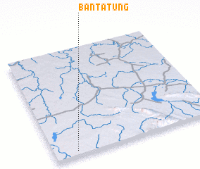 Places with similar names to Ban Tat Ung, Thailand ::
// Ban Dao Dong (TH)
// Ban Tat Thong (TH)
// Ban Tat Ung (TH)
// Ban To Daeng (TH)
// Ban To Deng (TH)
// Boundétingou (BJ)
// Bandatenga (BF)
// Bontotangga (ID)
// Ban Tattong (LA)
// Ban Touting (LA)
Disclaimer :: Information on this page comes without warranty of any kind |
||
|
Where is Ban Tat Ung? Elevation and coordinates ::
Latitude (lat): 17°2'51"N Longitude (lon): 103°8'33"E
Elevation (approx.): 207m (map arrows pan, magnifying glasses zoom) |
||
|
Visiting Ban Tat Ung? Hotel/Accommodation ::
Book a hotel in Ban Tat Ung Travel Guide ::
Buy a travel guide for Thailand rental cars ::
car rental offers GPS waypoint ::
download a GPX waypoint (PoI) of Ban Tat Ung for your GPS receiver
|
||