|
search place name
|
||
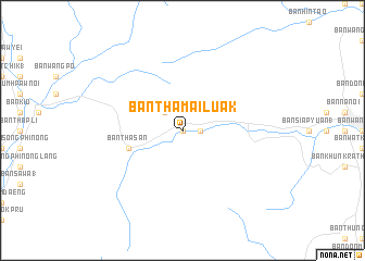
Ban Tha Mai Luak (Chumphon, Thailand)Ban Tha Mai Luak is a town in the Chumphon region of Thailand. An overview map of the region around Ban Tha Mai Luak is displayed below.
regional and 3d topo map of Ban Tha Mai Luak, Thailand ::
Ban Tha Mai Luak airports ::
The nearest airport is MGZ - Myeik, located 217.9 km north of Ban Tha Mai Luak.
Nearby towns ::
Ban Hin Mo (0.0km north) //
Ban Nong Khwa (1.8km east) //
Ban Hin Dang (2.6km north west) //
Ban Tha San (5.8km west) //
[all distances 'as the bird flies' and approximate] 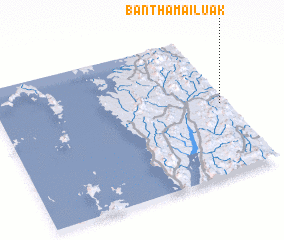 Places with similar names to Ban Tha Mai Luak, Thailand ::
// Ban Thamlèk (LA)
Disclaimer :: Information on this page comes without warranty of any kind |
||
|
Where is Ban Tha Mai Luak? Elevation and coordinates ::
Latitude (lat): 10°30'0"N Longitude (lon): 98°58'0"E
Elevation (approx.): 56m (map arrows pan, magnifying glasses zoom) |
||
|
Visiting Ban Tha Mai Luak? Hotel/Accommodation ::
Book a hotel in Ban Tha Mai Luak Travel Guide ::
Buy a travel guide for Thailand rental cars ::
car rental offers GPS waypoint ::
download a GPX waypoint (PoI) of Ban Tha Mai Luak for your GPS receiver
|
||