|
search place name
|
||
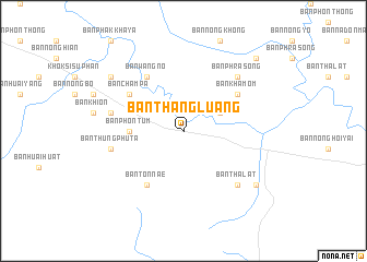
Ban Thang Luang (Nakhon Phanom, Thailand)Ban Thang Luang is a town in the Nakhon Phanom region of Thailand. An overview map of the region around Ban Thang Luang is displayed below.
regional and 3d topo map of Ban Thang Luang, Thailand ::
Ban Thang Luang airports ::
The nearest airport is SNO - Sakon Nakhon, located 45.9 km north west of Ban Thang Luang.
Other airports nearby include ZVK - Savannakhet (53.6 km south east), UTH - Udon Thani (185.0 km west), VTE - Vientiane Wattay Intl (232.5 km north west), PKZ - Pakse (245.5 km south east), Nearby towns ::
Na Kae (4.0km north east) //
Ban Phon Tum (5.3km west) //
Ban Kham Om (6.5km north east) //
Ban Champa (6.5km north west) //
Amphoe Na Kae (6.6km south west) //
Ban Na Kham (6.6km north west) //
Ban Nong Khong (6.6km north west) //
Ban Ton Nae (6.6km south west) //
Ban Wang No (6.6km north west) //
Ban Thung Phu Ta (7.3km west) //
Ban Na Phu (7.3km west) //
Ban Na Nua (7.7km north east) //
Ban Nong Hoi Yai (7.7km south east) //
Ban Phra Song (7.7km north east) //
Ban Tha Lat (7.7km south east) //
Ban Dong Noi (9.0km south east) //
Ban Dong Bang (9.0km north west) //
Ban Na Nua (10.3km north east) //
[all distances 'as the bird flies' and approximate]  Places with similar names to Ban Thang Luang, Thailand ::
// Ban Thang Luang (TH)
// Ban Thang Luang (TH)
// Ban Thong Lang (TH)
// Ban Thong Lang (TH)
// Ban Thong Lang (TH)
// Ban Thong Lang (TH)
// Ban Thong Lang (TH)
// Ban Thong Lang (TH)
// Ban Thong Lang (TH)
// Ban Thonglang (TH)
Disclaimer :: Information on this page comes without warranty of any kind |
||
|
Where is Ban Thang Luang? Elevation and coordinates ::
Latitude (lat): 16°57'0"N Longitude (lon): 104°28'0"E
Elevation (approx.): 155m (map arrows pan, magnifying glasses zoom) |
||
|
Visiting Ban Thang Luang? Hotel/Accommodation ::
Book a hotel in Ban Thang Luang Travel Guide ::
Buy a travel guide for Thailand rental cars ::
car rental offers GPS waypoint ::
download a GPX waypoint (PoI) of Ban Thang Luang for your GPS receiver
|
||