|
search place name
|
||
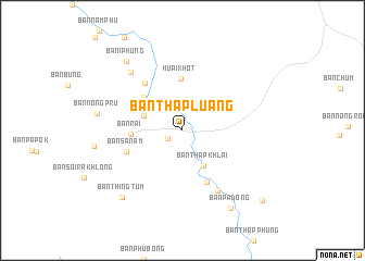
Ban Thap Luang (Uthai Thani, Thailand)Ban Thap Luang is a town in the Uthai Thani region of Thailand. An overview map of the region around Ban Thap Luang is displayed below.
regional and 3d topo map of Ban Thap Luang, Thailand ::
Ban Thap Luang airports ::
The nearest airport is BKK - Bangkok Intl, located 171.4 km south east of Ban Thap Luang.
Other airports nearby include PHS - Phitsanulok (202.6 km north), Nearby towns ::
Ban Phung Klan (1.7km south west) //
Ban Pha Thung (3.9km north west) //
Ban Thap Khlai (4.2km south east) //
Ban Pha Thang (1) (4.1km west) //
Ban Huai Haeng (5.1km north west) //
Huai Khot (5.3km north) //
Ban Rai (5.1km west) //
Ban Pa Bua (5.8km south east) //
Ban Sanam (6.0km west) //
Ban Chao Wat (6.1km north west) //
Ban Pa Daeng (7.1km south east) //
Ban I Phung (7.8km north west) //
Ban Nong Pru (8.7km west) //
Ban I Phung (9.0km north west) //
Ban Thing Tum (9.2km south west) //
Ban Pa Dong (9.3km south east) //
Ban Chan (10.7km south east) //
[all distances 'as the bird flies' and approximate] 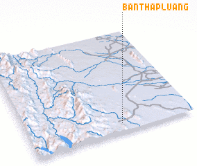 Places with similar names to Ban Thap Luang, Thailand ::
// Ban Tha Pling (TH)
// Ban Thap Luang (TH)
Disclaimer :: Information on this page comes without warranty of any kind |
||
|
Where is Ban Thap Luang? Elevation and coordinates ::
Latitude (lat): 15°5'10"N Longitude (lon): 99°34'7"E
Elevation (approx.): 131m (map arrows pan, magnifying glasses zoom) |
||
|
Visiting Ban Thap Luang? Hotel/Accommodation ::
Book a hotel in Ban Thap Luang Travel Guide ::
Buy a travel guide for Thailand rental cars ::
car rental offers GPS waypoint ::
download a GPX waypoint (PoI) of Ban Thap Luang for your GPS receiver
|
||