|
search place name
|
||
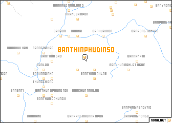
Ban Thin Phu Dinso (Nan, Thailand)Ban Thin Phu Dinso is a town in the Nan region of Thailand. An overview map of the region around Ban Thin Phu Dinso is displayed below.
regional and 3d topo map of Ban Thin Phu Dinso, Thailand ::
Ban Thin Phu Dinso airports ::
The nearest airport is LPQ - Luang Prabang Luang Phabang Intl, located 134.0 km east of Ban Thin Phu Dinso.
Other airports nearby include THL - Tachilek Tachileik (156.0 km north west), PRH - Phrae (170.2 km south west), LPT - Lampang (203.1 km south west), MOG - Mong Hsat (213.4 km north west), Nearby towns ::
Ban Pang Rai Nam Ngop (2.5km south east) //
Ban Nam Ao (1) (2.5km south west) //
Ban Thin Nam Lae (4.1km south east) //
Ban Mai (5.8km north) //
Ban Huai Kon (6.6km north east) //
Ban Nam Nan (6.6km north west) //
Ban Thung Ao (7.0km west) //
Ban Khun Nam Lae (7.4km south) //
Ban Ngop (7.2km west) //
Ban Sun (7.2km west) //
Ban Pon (7.6km north west) //
Ban Dong (7.6km north west) //
Ban Dong (7.9km south west) //
Ban Thung Phung Noi (10.2km south west) //
[all distances 'as the bird flies' and approximate] 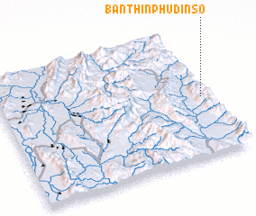 Places with similar names to Ban Thin Phu Dinso, Thailand :: Disclaimer :: Information on this page comes without warranty of any kind |
||
|
Where is Ban Thin Phu Dinso? Elevation and coordinates ::
Latitude (lat): 19°28'0"N Longitude (lon): 100°58'0"E
Elevation (approx.): 873m (map arrows pan, magnifying glasses zoom) |
||
|
Visiting Ban Thin Phu Dinso? Hotel/Accommodation ::
Book a hotel in Ban Thin Phu Dinso Travel Guide ::
Buy a travel guide for Thailand rental cars ::
car rental offers GPS waypoint ::
download a GPX waypoint (PoI) of Ban Thin Phu Dinso for your GPS receiver
|
||