|
search place name
|
||
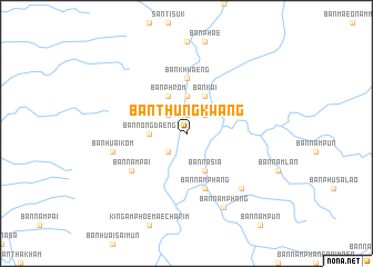
Ban Thung Kwang (Nan, Thailand)Ban Thung Kwang is a town in the Nan region of Thailand. An overview map of the region around Ban Thung Kwang is displayed below.
regional and 3d topo map of Ban Thung Kwang, Thailand ::
Ban Thung Kwang airports ::
The nearest airport is PRH - Phrae, located 109.8 km south west of Ban Thung Kwang.
Other airports nearby include LOE - Loei (158.3 km south east), LPT - Lampang (166.6 km west), LPQ - Luang Prabang Luang Phabang Intl (179.0 km north east), VTE - Vientiane Wattay Intl (181.5 km south east), Nearby towns ::
Ban Na Kha (1.9km north) //
Mae Charim (2.6km north east) //
Ban Bong (2.6km south west) //
Ban Huai So (2.6km south west) //
Ban Mo Muang (2.6km south west) //
Ban Pao (2.6km north west) //
Ban Nong Daeng (3.7km north) //
Ban Nong Daeng (3.5km west) //
Ban Na Noi (3.5km west) //
Ban Na Sia (4.1km south east) //
Ban Kai (4.1km north east) //
Ban Phrom (4.1km north west) //
Ban Khwaeng (5.6km north) //
Ban Nam Phang (5.8km south) //
Ban Nam Pai (6.4km south west) //
Ban Huai Kom (7.3km west) //
Ban Nam Nae (7.7km south east) //
Ban Nam Phang (8.2km south east) //
[all distances 'as the bird flies' and approximate]  Places with similar names to Ban Thung Kwang, Thailand ::
// Ban Thang Khwang (TH)
// Ban Thung Khwang (TH)
// Ban Thung Khwang (TH)
// Ban Thung Khwang (TH)
// Ban Thung Khwang (TH)
// Ban Thung Khwang (TH)
// Ban Thung Kwang (TH)
// Ban Thung Kwang (TH)
// Ban Thung Kwang (TH)
Disclaimer :: Information on this page comes without warranty of any kind |
||
|
Where is Ban Thung Kwang? Elevation and coordinates ::
Latitude (lat): 18°42'0"N Longitude (lon): 101°1'0"E
Elevation (approx.): 433m (map arrows pan, magnifying glasses zoom) |
||
|
Visiting Ban Thung Kwang? Hotel/Accommodation ::
Book a hotel in Ban Thung Kwang Travel Guide ::
Buy a travel guide for Thailand rental cars ::
car rental offers GPS waypoint ::
download a GPX waypoint (PoI) of Ban Thung Kwang for your GPS receiver
|
||