|
search place name
|
||
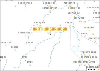
Ban Thung Mai Ngam (Songkhla, Thailand)Ban Thung Mai Ngam is a town in the Songkhla region of Thailand. An overview map of the region around Ban Thung Mai Ngam is displayed below.
regional and 3d topo map of Ban Thung Mai Ngam, Thailand ::
Ban Thung Mai Ngam airports ::
The nearest airport is PAN - Pattani, located 37.3 km north east of Ban Thung Mai Ngam.
Other airports nearby include HDY - Songkhla Hat Yai Intl (66.6 km north west), AOR - Alor Setar Sultan Abdul Halim (69.1 km south west), NAW - Narathiwat (95.4 km east), LGK - Pulau Langkawi Intl (130.8 km west), Nearby towns ::
Amphoe Saba Yoi (1.9km north) //
Ban Khuha (4.1km north west) //
Ban Thung Pho (4.1km north east) //
Ban Sai Khao (5.2km north west) //
Ban Lam Tuai (5.2km north east) //
Ban Rai (8.2km south west) //
Saba Yoi (8.2km north east) //
[all distances 'as the bird flies' and approximate]  Places with similar names to Ban Thung Mai Ngam, Thailand :: Disclaimer :: Information on this page comes without warranty of any kind |
||
|
Where is Ban Thung Mai Ngam? Elevation and coordinates ::
Latitude (lat): 6°35'0"N Longitude (lon): 100°53'0"E
Elevation (approx.): 37m (map arrows pan, magnifying glasses zoom) |
||
|
Visiting Ban Thung Mai Ngam? Hotel/Accommodation ::
Book a hotel in Ban Thung Mai Ngam Travel Guide ::
Buy a travel guide for Thailand rental cars ::
car rental offers GPS waypoint ::
download a GPX waypoint (PoI) of Ban Thung Mai Ngam for your GPS receiver
|
||