|
search place name
|
||
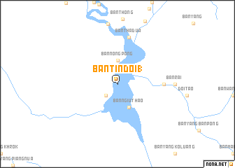
Ban Tin Doi (1) (Chiang Mai, Thailand)Ban Tin Doi (1) is a town in the Chiang Mai region of Thailand. An overview map of the region around Ban Tin Doi (1) is displayed below.
regional and 3d topo map of Ban Tin Doi (1), Thailand ::
Ban Tin Doi (1) airports ::
The nearest airport is LPT - Lampang, located 100.2 km north east of Ban Tin Doi (1).
Other airports nearby include PRH - Phrae (163.9 km east), PHS - Phitsanulok (215.3 km south east), Nearby towns ::
Ban Lao Manao (2.6km south west) //
Ban Den Ta Nua (2.6km south west) //
Ban Noi (2.6km south west) //
Ban Nong Bua Kham (2.6km south west) //
Ban Pha Chuk (2.6km south west) //
Ban Tha Khrang (2.6km south west) //
Ban Tin Doi (2.6km south west) //
Ban Nong Pong (3.7km north) //
Ban Ngiu Thao (4.1km south east) //
Ban Mut Ka (1) (4.1km south east) //
Ban Pha Chuk (7.1km east) //
Ban Tha Dua (7.6km north) //
[all distances 'as the bird flies' and approximate]  Places with similar names to Ban Tin Doi (1), Thailand :: Disclaimer :: Information on this page comes without warranty of any kind |
||
|
Where is Ban Tin Doi (1)? Elevation and coordinates ::
Latitude (lat): 17°55'0"N Longitude (lon): 98°38'0"E
Elevation (approx.): 241m (map arrows pan, magnifying glasses zoom) |
||
|
Visiting Ban Tin Doi (1)? Hotel/Accommodation ::
Book a hotel in Ban Tin Doi (1) Travel Guide ::
Buy a travel guide for Thailand rental cars ::
car rental offers GPS waypoint ::
download a GPX waypoint (PoI) of Ban Tin Doi (1) for your GPS receiver
|
||