|
search place name
|
||
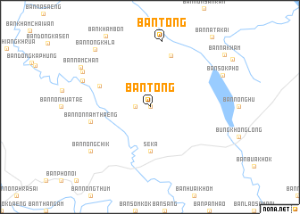
Ban Tong (Thailand)Ban Tong is a town in Thailand. An overview map of the region around Ban Tong is displayed below.
regional and 3d topo map of Ban Tong, Thailand ::
Ban Tong airports ::
The nearest airport is SNO - Sakon Nakhon, located 89.1 km south of Ban Tong.
Other airports nearby include UTH - Udon Thani (139.8 km south west), VTE - Vientiane Wattay Intl (146.9 km west), ZVK - Savannakhet (179.8 km south east), LPQ - Luang Prabang Luang Phabang Intl (283.6 km north west), Nearby towns ::
Ban Na Takai (0.0km north) //
Ban Khok Kasae (0.0km north) //
Ban Sok Kam (0.0km north) //
Ban Na Kham (0.0km north) //
Ban Huai Phak Kha (1.8km west) //
Seka (5.6km south) //
Ban Non Muat Ae (6.6km north west) //
Ban Khok Kasae (6.9km north) //
Ban Non Nam Thaeng (7.3km west) //
Ban Tong (8.3km north) //
Ban Tha Muang (8.6km west) //
Ban Nong Chik (9.0km south west) //
Ban Lao Kham (9.1km north west) //
Ban Nong Khla (9.7km north west) //
Ban Nam Chan (9.6km north west) //
Ban Kham Bon (10.3km north west) //
Ban Na Ta Kai (11.5km north east) //
[all distances 'as the bird flies' and approximate]  Places with similar names to Ban Tong, Thailand ::
Disclaimer :: Information on this page comes without warranty of any kind |
||
|
Where is Ban Tong? Elevation and coordinates ::
Latitude (lat): 17°59'0"N Longitude (lon): 103°57'0"E
Elevation (approx.): 165m (map arrows pan, magnifying glasses zoom) |
||
|
Visiting Ban Tong? Hotel/Accommodation ::
Book a hotel in Ban Tong Travel Guide ::
Buy a travel guide for Thailand rental cars ::
car rental offers GPS waypoint ::
download a GPX waypoint (PoI) of Ban Tong for your GPS receiver
|
||