|
search place name
|
||
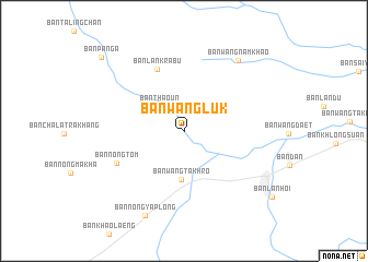
Ban Wang Luk (Sukhothai, Thailand)Ban Wang Luk is a town in the Sukhothai region of Thailand. An overview map of the region around Ban Wang Luk is displayed below.
regional and 3d topo map of Ban Wang Luk, Thailand ::
Ban Wang Luk airports ::
The nearest airport is PHS - Phitsanulok, located 87.7 km east of Ban Wang Luk.
Other airports nearby include LPT - Lampang (135.7 km north), PRH - Phrae (139.4 km north east), Nearby towns ::
Ban Thao Un (3.5km north west) //
Ban Wang Takhro (4.9km south) //
Ban Lan Krabu (6.8km north) //
Ban Nong Tom (7.3km south west) //
Ban Wang Nam Khao (8.9km north east) //
Ban Nong Ya Plong (9.4km south west) //
Ban Pang A (11.1km north west) //
[all distances 'as the bird flies' and approximate] 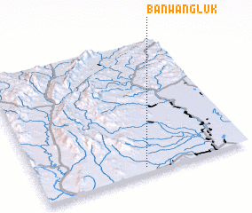 Places with similar names to Ban Wang Luk, Thailand ::
Disclaimer :: Information on this page comes without warranty of any kind |
||
|
Where is Ban Wang Luk? Elevation and coordinates ::
Latitude (lat): 17°2'40"N Longitude (lon): 99°30'8"E
Elevation (approx.): 93m (map arrows pan, magnifying glasses zoom) |
||
|
Visiting Ban Wang Luk? Hotel/Accommodation ::
Book a hotel in Ban Wang Luk Travel Guide ::
Buy a travel guide for Thailand rental cars ::
car rental offers GPS waypoint ::
download a GPX waypoint (PoI) of Ban Wang Luk for your GPS receiver
|
||