|
search place name
|
||
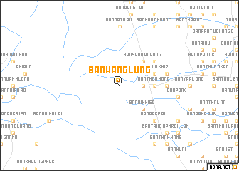
Ban Wang Lung (Nakhon Si Thammarat, Thailand)Ban Wang Lung is a town in the Nakhon Si Thammarat region of Thailand. An overview map of the region around Ban Wang Lung is displayed below.
regional and 3d topo map of Ban Wang Lung, Thailand ::
Ban Wang Lung airports ::
The nearest airport is NST - Nakhon Si Thammarat Cha Ian, located 24.2 km south east of Ban Wang Lung.
Other airports nearby include TST - Trang (120.0 km south), HKT - Phuket Intl (167.9 km west), HDY - Songkhla Hat Yai Intl (195.1 km south), PAN - Pattani (250.9 km south east), Nearby towns ::
Ban Huai Teng (3.7km east) //
Ban Ai Khieo (5.2km south east) //
Ban Saphan Rang (5.2km north east) //
Ban Chum Khling (1) (5.5km east) //
Ban Thon Hong (5.5km east) //
Phrommakhiri (5.8km east) //
Ban Nai Thun (6.6km north east) //
Ban Na Klang (7.3km east) //
Ban Sakha (7.6km east) //
Ban Pak Ram (7.8km south east) //
Ban Tam on Phrom Lok (10.4km south east) //
[all distances 'as the bird flies' and approximate]  Places with similar names to Ban Wang Lung, Thailand ::
// Ban Wang Lang (TH)
// Ban Wang Liang (TH)
// Ban Wang Luang (TH)
// Ban Wang Luang (TH)
// Ban Wang Lung (TH)
Disclaimer :: Information on this page comes without warranty of any kind |
||
|
Where is Ban Wang Lung? Elevation and coordinates ::
Latitude (lat): 8°35'0"N Longitude (lon): 99°46'0"E
Elevation (approx.): 311m (map arrows pan, magnifying glasses zoom) |
||
|
Visiting Ban Wang Lung? Hotel/Accommodation ::
Book a hotel in Ban Wang Lung Travel Guide ::
Buy a travel guide for Thailand rental cars ::
car rental offers GPS waypoint ::
download a GPX waypoint (PoI) of Ban Wang Lung for your GPS receiver
|
||