|
search place name
|
||
Ban Wang Na (1) (Nakhon Sawan, Thailand)Ban Wang Na (1) is a town in the Nakhon Sawan region of Thailand. An overview map of the region around Ban Wang Na (1) is displayed below.
regional and 3d topo map of Ban Wang Na (1), Thailand ::

Ban Wang Na (1) airports ::
The nearest airport is PHS - Phitsanulok, located 112.5 km north of Ban Wang Na (1).
Other airports nearby include BKK - Bangkok Intl (208.4 km south), NAK - Nakhon Ratchasima Khorat (215.2 km south east), LOE - Loei (241.6 km north east), Nearby towns ::
Ban Yan Sawai (1) (1.9km north) //
Ban Thap Krit (2.6km south west) //
Ban Wang Na (2.6km south west) //
Ban Ton Pho (4.1km north west) //
Ban Hua Thanon Nua (4.0km north west) //
Ban Tha Bua (5.1km south west) //
Ban Tha Chang (5.1km south west) //
Ban Khlong Pla Kot Nai (5.8km north) //
Ban Ton Pho Tai (5.8km north) //
Ban Nong Khlo (1) (6.6km north east) //
Ban Laem Prada (6.5km south east) //
Ban Tha Mai (7.1km west) //
Ban Dong Mao (7.6km north) //
Ban Khok Mo (7.6km north) //
Ban Sua Kameng (7.4km west) //
Ban Tha Lo (7.4km west) //
Ban Lat (9.1km north west) //
Ban Prathap Ron (10.3km north east) //
[all distances 'as the bird flies' and approximate] 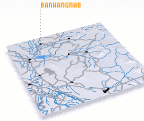 Places with similar names to Ban Wang Na (1), Thailand :: Disclaimer :: Information on this page comes without warranty of any kind |
||
|
Where is Ban Wang Na (1)? Elevation and coordinates ::
Latitude (lat): 15°46'0"N Longitude (lon): 100°16'0"E
Elevation (approx.): 25m (map arrows pan, magnifying glasses zoom) |
||
|
Visiting Ban Wang Na (1)? Hotel/Accommodation ::
Book a hotel in Ban Wang Na (1) Travel Guide ::
Buy a travel guide for Thailand rental cars ::
car rental offers GPS waypoint ::
download a GPX waypoint (PoI) of Ban Wang Na (1) for your GPS receiver
|
||