|
search place name
|
||
Ban Wang Phong (Chai Nat, Thailand)Ban Wang Phong is a town in the Chai Nat region of Thailand. An overview map of the region around Ban Wang Phong is displayed below.
regional and 3d topo map of Ban Wang Phong, Thailand ::

Ban Wang Phong airports ::
The nearest airport is PHS - Phitsanulok, located 174.2 km north of Ban Wang Phong.
Other airports nearby include BKK - Bangkok Intl (180.1 km south east), Nearby towns ::
Ban Thung Na (1.6km west) //
Ban Khok Sawang (2.2km east) //
Ban Thung Man (3.6km south west) //
Ban Rai Yai (3.6km east) //
Ban Nong Bua (5.0km north east) //
Ban Bo Luk (5.1km south east) //
Ban Nong Masang (5.3km west) //
Ban Huai Kha Nang (5.6km north east) //
Ban Nong Bua (1) (5.7km east) //
Ban Mamuang Wan (7.2km north) //
Ban Khao Noi (7.3km north west) //
Ban Nong Pla Lai (8.6km south east) //
Ban Ko Ai Song (9.0km north east) //
Ban Nong Ya Plong (1) (10.3km north east) //
Ban Thung Pho (11.2km north east) //
[all distances 'as the bird flies' and approximate] 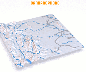 Places with similar names to Ban Wang Phong, Thailand ::
// Ban Wang Phang (TH)
// Ban Wang Phong (TH)
Disclaimer :: Information on this page comes without warranty of any kind |
||
|
Where is Ban Wang Phong? Elevation and coordinates ::
Latitude (lat): 15°18'0"N Longitude (lon): 99°44'0"E
Elevation (approx.): 62m (map arrows pan, magnifying glasses zoom) |
||
|
Visiting Ban Wang Phong? Hotel/Accommodation ::
Book a hotel in Ban Wang Phong Travel Guide ::
Buy a travel guide for Thailand rental cars ::
car rental offers GPS waypoint ::
download a GPX waypoint (PoI) of Ban Wang Phong for your GPS receiver
|
||