|
search place name
|
||
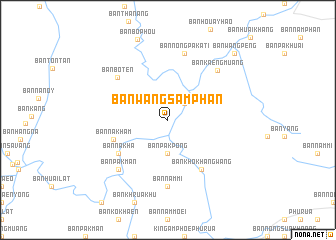
Ban Wang Sam Phan (Loei, Thailand)Ban Wang Sam Phan is a town in the Loei region of Thailand. An overview map of the region around Ban Wang Sam Phan is displayed below.
regional and 3d topo map of Ban Wang Sam Phan, Thailand ::
Ban Wang Sam Phan airports ::
The nearest airport is LOE - Loei, located 53.3 km east of Ban Wang Sam Phan.
Other airports nearby include PRH - Phrae (130.3 km north west), PHS - Phitsanulok (132.3 km south west), VTE - Vientiane Wattay Intl (149.1 km east), UTH - Udon Thani (166.1 km east), Nearby towns ::
Ban Nam Hoi (2.6km north east) //
Ban Pak Pong (3.7km south) //
Ban Nakham (6.2km west) //
Ban Na Kha (6.5km south west) //
Ban Khok Hang Wang (6.6km south east) //
Ban Botèn (7.2km north west) //
Ban Nam Mi (7.4km south) //
Ban Nong Pakati (7.6km north) //
Ban A Hi (7.6km north) //
Ban Pak Man (7.7km south west) //
Ban Kaeng Muang (7.7km north east) //
Ban Wang Peng (10.2km north east) //
[all distances 'as the bird flies' and approximate]  Places with similar names to Ban Wang Sam Phan, Thailand ::
// Ban Wang Samphan (TH)
Disclaimer :: Information on this page comes without warranty of any kind |
||
|
Where is Ban Wang Sam Phan? Elevation and coordinates ::
Latitude (lat): 17°33'0"N Longitude (lon): 101°14'0"E
Elevation (approx.): 342m (map arrows pan, magnifying glasses zoom) |
||
|
Visiting Ban Wang Sam Phan? Hotel/Accommodation ::
Book a hotel in Ban Wang Sam Phan Travel Guide ::
Buy a travel guide for Thailand rental cars ::
car rental offers GPS waypoint ::
download a GPX waypoint (PoI) of Ban Wang Sam Phan for your GPS receiver
|
||