|
search place name
|
||
Ban Yang Mae Pon (Chiang Mai, Thailand)Ban Yang Mae Pon is a town in the Chiang Mai region of Thailand. An overview map of the region around Ban Yang Mae Pon is displayed below.
regional and 3d topo map of Ban Yang Mae Pon, Thailand ::

Ban Yang Mae Pon airports ::
The nearest airport is LPT - Lampang, located 101.9 km east of Ban Yang Mae Pon.
Other airports nearby include PRH - Phrae (173.5 km east), PHS - Phitsanulok (261.4 km south east), Nearby towns ::
Ban Mae Aep Nai (3.6km north east) //
Ban Tun (3.8km south west) //
Ban Mae Aep Nok (5.2km north east) //
Ban Yang (6.1km north) //
Ban Huai Pu Ling (6.1km south west) //
Ban Sop Mae Klang (6.8km north) //
Ban Na Yang (6.7km north west) //
Ban Yang (8.1km north) //
Ban Tat Mun (8.3km east) //
Ban Yang (8.5km south west) //
Ban Hua Sua (8.7km east) //
Ban Yang Khun Ya (9.4km south west) //
Ban Yang (11.5km north east) //
[all distances 'as the bird flies' and approximate] 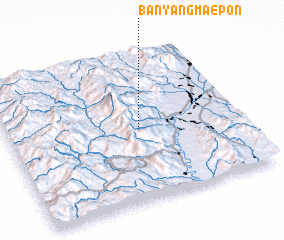 Places with similar names to Ban Yang Mae Pon, Thailand :: Disclaimer :: Information on this page comes without warranty of any kind |
||
|
Where is Ban Yang Mae Pon? Elevation and coordinates ::
Latitude (lat): 18°28'45"N Longitude (lon): 98°33'53"E
Elevation (approx.): 902m (map arrows pan, magnifying glasses zoom) |
||
|
Visiting Ban Yang Mae Pon? Hotel/Accommodation ::
Book a hotel in Ban Yang Mae Pon Travel Guide ::
Buy a travel guide for Thailand rental cars ::
car rental offers GPS waypoint ::
download a GPX waypoint (PoI) of Ban Yang Mae Pon for your GPS receiver
|
||