|
search place name
|
||
Kampong Chuming (Narathiwat, Thailand)Kampong Chuming is a town in the Narathiwat region of Thailand. An overview map of the region around Kampong Chuming is displayed below.
regional and 3d topo map of Kampong Chuming, Thailand ::

Kampong Chuming airports ::
The nearest airport is KBR - Kota Bahru Sultan Ismail Petra, located 37.3 km north east of Kampong Chuming.
Other airports nearby include NAW - Narathiwat (60.0 km north west), PAN - Pattani (123.9 km north west), TGG - Kuala Terengganu Sultan Mahmud (143.4 km south east), AOR - Alor Setar Sultan Abdul Halim (176.3 km west), Nearby towns ::
Kampong Baka (0.0km north) //
Kampong Rantau Panjang (1.9km south) //
Kampong Banggol Kulim (1.9km south) //
Rantau Panjang (1.9km south) //
Kampong Banggol Chekur (1.8km east) //
Kampong Kedap (1.8km east) //
Kampong Lubok Gong (1.8km east) //
Sungai Kolok (1.9km south west) //
Kampong Tasek (2.6km south east) //
Kampong Gual Machang (2.6km south east) //
Kampong Tasek Batu (2.6km south east) //
Kampong Kubang Rambutan (3.7km south) //
Kampong Gual Pasong Hantu (3.7km south) //
Kampong Banggol Mek Pit (3.7km south) //
Kampong Bagus (3.7km south) //
Kampong Gual Nibong (3.7km east) //
Kampong Tanyong Bale (4.1km south west) //
Kampong Gual Petai (4.1km south east) //
Kampong Tasek China (4.1km south east) //
Kampong Kebakat (4.1km south east) //
Kampong Kob Kiyeh (4.1km south east) //
Kampong Gual Nering (4.1km south east) //
Kampong Bakat (4.1km south east) //
Kampong Tok Dih (4.1km north east) //
Kampong Geretak Nombor Tiga (5.2km south east) //
Kampong Kusar (5.2km south east) //
Kampong Tasik Gading (5.2km south east) //
Ban La Lae (5.2km north east) //
Ban To Daeng (5.7km north) //
[all distances 'as the bird flies' and approximate] 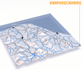 Places with similar names to Kampong Chuming, Thailand ::
// Kampong Chembong (MY)
// Kampong Chembong (MY)
Disclaimer :: Information on this page comes without warranty of any kind |
||
|
Where is Kampong Chuming? Elevation and coordinates ::
Latitude (lat): 6°2'0"N Longitude (lon): 101°59'0"E
Elevation (approx.): 17m (map arrows pan, magnifying glasses zoom) |
||
|
Visiting Kampong Chuming? Hotel/Accommodation ::
Book a hotel in Kampong Chuming Travel Guide ::
Buy a travel guide for Thailand rental cars ::
car rental offers GPS waypoint ::
download a GPX waypoint (PoI) of Kampong Chuming for your GPS receiver
|
||