|
search place name
|
||
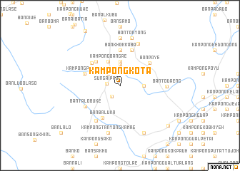
Kampong Kota (Narathiwat, Thailand)Kampong Kota is a town in the Narathiwat region of Thailand. An overview map of the region around Kampong Kota is displayed below.
regional and 3d topo map of Kampong Kota, Thailand ::
Kampong Kota airports ::
The nearest airport is KBR - Kota Bahru Sultan Ismail Petra, located 44.5 km east of Kampong Kota.
Other airports nearby include NAW - Narathiwat (51.3 km north), PAN - Pattani (113.3 km north west), TGG - Kuala Terengganu Sultan Mahmud (154.2 km south east), AOR - Alor Setar Sultan Abdul Halim (166.6 km west), Nearby towns ::
Sungai Padi (2.1km west) //
Ban Lahan (2.1km south west) //
Kampong Aiketu (2.6km north west) //
Kampong Padai (2.6km north west) //
Kampong Bangetaimati (2.6km north west) //
Ban Pa Lu Ru (3.3km north) //
Ban Katase (3.7km east) //
Ban Pu Lu Ru (3.7km north) //
Kampong Bangae (4.1km north west) //
Ban Karo (5.2km north west) //
Ban Khok Kaba (5.6km north) //
Ban To Deng (5.7km north west) //
Ban Ba Lu Ka (5.7km south west) //
Ban Pa Ye (5.8km north east) //
Ban Mai (5.9km north) //
Ban Khok Phai (5.9km north) //
Ban Sai Tathubit (5.9km north) //
Kampong Pulong (5.8km west) //
Kampong Palumo (5.8km west) //
Ban Talo Bu Ke (6.3km south west) //
Kampong Talobuke (6.7km south west) //
Ban Cho Kot (7.1km north east) //
Ban To Daeng (7.3km east) //
Ban Sungai Padi (7.4km north) //
Kampong Tanyong Kamae (7.6km south) //
Ban Ton Yang (7.6km north) //
Kampong Ka Kheng (8.3km south east) //
Sungai Kolok (9.8km south east) //
Ban Ba Ngo Ai Sa (10.1km north west) //
[all distances 'as the bird flies' and approximate]  Places with similar names to Kampong Kota, Thailand ::
// Kampong Kut (MY)
// Kampong Aiketu (TH)
// Kampong Koto (TH)
// Kâmpóng Kdei (KH)
// Kampong Kaid (MY)
// Kampong Kedah (MY)
// Kampong Kedah (MY)
// Kampong Kedah (MY)
// Kampong Kedah (MY)
// Kampong Kedah (MY)
Disclaimer :: Information on this page comes without warranty of any kind |
||
|
Where is Kampong Kota? Elevation and coordinates ::
Latitude (lat): 6°5'0"N Longitude (lon): 101°54'0"E
Elevation (approx.): 25m (map arrows pan, magnifying glasses zoom) |
||
|
Visiting Kampong Kota? Hotel/Accommodation ::
Book a hotel in Kampong Kota Travel Guide ::
Buy a travel guide for Thailand rental cars ::
car rental offers GPS waypoint ::
download a GPX waypoint (PoI) of Kampong Kota for your GPS receiver
|
||