|
search place name
|
||
Kampong Maluka (Narathiwat, Thailand)Kampong Maluka is a town in the Narathiwat region of Thailand. An overview map of the region around Kampong Maluka is displayed below.
regional and 3d topo map of Kampong Maluka, Thailand ::

Kampong Maluka airports ::
The nearest airport is NAW - Narathiwat, located 27.2 km north east of Kampong Maluka.
Other airports nearby include PAN - Pattani (69.0 km north west), KBR - Kota Bahru Sultan Ismail Petra (80.7 km east), AOR - Alor Setar Sultan Abdul Halim (132.1 km west), HDY - Songkhla Hat Yai Intl (147.4 km north west), Nearby towns ::
Kampong Aila (1.8km east) //
Kampong Lalo Thawo (1.9km north) //
Amphoe Yingo (4.1km south east) //
Ban Ma Ru Bo (4.1km north east) //
Ban Tan Yong (4.6km north) //
Kampong Lawen (5.9km south) //
Ban Tha Rua (5.8km west) //
Ban La Weng (6.6km south west) //
Ban Ku Ching Ru Pa (7.0km south east) //
Ban Lu Bo (7.1km north) //
Kampong Bakong (7.6km west) //
Kampong Lubobatu (7.8km south west) //
Kampong Maluka (7.8km north west) //
Ban Ya Kong (8.3km west) //
Ruso (9.7km north west) //
[all distances 'as the bird flies' and approximate] 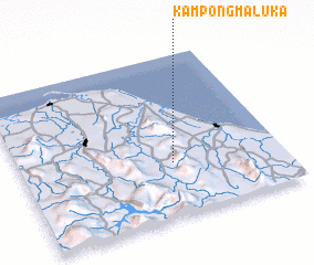 Places with similar names to Kampong Maluka, Thailand ::
// Kampong Maligai (MY)
// Kampong Melaka (MY)
// Kampong Melaka (MY)
// Kampong Melaka (MY)
// Kampong Melikai (MY)
// Kampong Molek (MY)
// Kampong Maluka (TH)
// Kampong Maluka (TH)
// Kampong Maluka (TH)
Disclaimer :: Information on this page comes without warranty of any kind |
||
|
Where is Kampong Maluka? Elevation and coordinates ::
Latitude (lat): 6°20'0"N Longitude (lon): 101°35'0"E
Elevation (approx.): 63m (map arrows pan, magnifying glasses zoom) |
||
|
Visiting Kampong Maluka? Hotel/Accommodation ::
Book a hotel in Kampong Maluka Travel Guide ::
Buy a travel guide for Thailand rental cars ::
car rental offers GPS waypoint ::
download a GPX waypoint (PoI) of Kampong Maluka for your GPS receiver
|
||