|
search place name
|
||
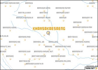
Kham Sakae Saeng (Nakhon Ratchasima, Thailand)Kham Sakae Saeng is a town in the Nakhon Ratchasima region of Thailand. An overview map of the region around Kham Sakae Saeng is displayed below.
regional and 3d topo map of Kham Sakae Saeng, Thailand ::
Kham Sakae Saeng airports ::
The nearest airport is NAK - Nakhon Ratchasima Khorat, located 45.5 km south of Kham Sakae Saeng.
Other airports nearby include BKK - Bangkok Intl (231.4 km south west), PHS - Phitsanulok (259.3 km north west), REP - Siem-reap Siem Reap (275.9 km south east), SNO - Sakon Nakhon (292.0 km north east), Nearby towns ::
Ban Kham (1.8km west) //
Ban Don Phangat (4.1km south west) //
Ban Klung (4.1km south east) //
Ban Maklua (5.1km south west) //
Ban Khu (5.6km south) //
Ban Non Chaeng (5.6km north) //
Ban Nong Phlong (5.7km east) //
Ban Non Ya Kha (5.8km north) //
Ban Khu Wuk (5.7km west) //
Ban Don Ngiu (6.6km south east) //
Ban Nong Khrua Chut (7.6km south) //
Ban Tako (7.6km north) //
Ban Makham Thao (7.7km south east) //
Ban Nua (7.7km north east) //
Ban Don Phawa (8.2km south east) //
Ban Muang Nat (9.1km north east) //
[all distances 'as the bird flies' and approximate] 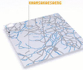 Places with similar names to Kham Sakae Saeng, Thailand :: Disclaimer :: Information on this page comes without warranty of any kind |
||
|
Where is Kham Sakae Saeng? Elevation and coordinates ::
Latitude (lat): 15°20'0"N Longitude (lon): 102°11'0"E
Elevation (approx.): 181m (map arrows pan, magnifying glasses zoom) |
||
|
Visiting Kham Sakae Saeng? Hotel/Accommodation ::
Book a hotel in Kham Sakae Saeng Travel Guide ::
Buy a travel guide for Thailand rental cars ::
car rental offers GPS waypoint ::
download a GPX waypoint (PoI) of Kham Sakae Saeng for your GPS receiver
|
||