|
search place name
|
||
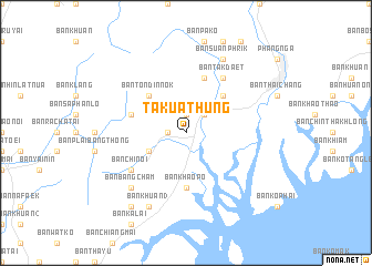
Takua Thung (Phangnga, Thailand)Takua Thung is a town in the Phangnga region of Thailand. An overview map of the region around Takua Thung is displayed below.
regional and 3d topo map of Takua Thung, Thailand ::
Takua Thung airports ::
The nearest airport is HKT - Phuket Intl, located 34.9 km south west of Takua Thung.
Other airports nearby include TST - Trang (162.0 km south east), NST - Nakhon Si Thammarat Cha Ian (166.0 km east), HDY - Songkhla Hat Yai Intl (268.8 km south east), Nearby towns ::
Ban Bang Mak (1.9km north) //
Ban Phan Phra (1.8km west) //
Ban Chin (2.6km north east) //
Ban Khum Mut (4.1km south west) //
Ban Bang Sai (4.1km south west) //
Ban Bang Yuan (5.2km north east) //
Ban Ton Din Nok (5.2km north west) //
Ban Khao Po (5.6km south) //
Ban Chuak Nang (5.8km west) //
Ban Hin Sam Kon (5.9km north) //
Ban Tak Daet (6.7km north east) //
Ban Chi Noi (6.6km south west) //
Ban Bang Cham (7.8km south west) //
Ban Khok (8.3km north east) //
Ban Suan Phrik (8.3km north east) //
Ban Khuan (3) (8.3km south west) //
Ban Bang Phrik (9.2km south west) //
[all distances 'as the bird flies' and approximate] 
Disclaimer :: Information on this page comes without warranty of any kind |
||
|
Where is Takua Thung? Elevation and coordinates ::
Latitude (lat): 8°24'0"N Longitude (lon): 98°27'0"E
Elevation (approx.): 23m (map arrows pan, magnifying glasses zoom) |
||
|
Visiting Takua Thung? Hotel/Accommodation ::
Book a hotel in Takua Thung Travel Guide ::
Buy a travel guide for Thailand rental cars ::
car rental offers GPS waypoint ::
download a GPX waypoint (PoI) of Takua Thung for your GPS receiver
|
||