|
search place name
|
||
Tha Uthen (Nakhon Phanom, Thailand)Tha Uthen is a town in the Nakhon Phanom region of Thailand. An overview map of the region around Tha Uthen is displayed below.
regional and 3d topo map of Tha Uthen, Thailand ::

Tha Uthen airports ::
The nearest airport is SNO - Sakon Nakhon, located 65.6 km south west of Tha Uthen.
Other airports nearby include ZVK - Savannakhet (113.1 km south), UTH - Udon Thani (193.5 km west), Nearby towns ::
Muang Hinboun (1.9km north) //
Ban Kasoem (1.9km south) //
Ban Khan (2.6km south west) //
Ban Klang (2.6km south west) //
Ban Hat-Hè (3.5km east) //
Ban Hat-Ikom (4.1km north west) //
Ban Ngiou (5.3km east) //
Ban Nakathat (5.8km north) //
Ban Nakho (7.1km east) //
Ban Phôkham (7.3km east) //
Ban Houaykhaomin (7.7km north west) //
Ban Ton (7.7km north east) //
Ban Poung Tai (8.0km north east) //
Ban Pak Thuai (8.0km south east) //
Ban Na Nai (9.1km south west) //
Ban Nongphu (9.0km north east) //
Ban Tha Champa (9.0km north west) //
[all distances 'as the bird flies' and approximate] 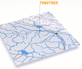 Places with similar names to Tha Uthen, Thailand ::
// Thathana (MM)
// Thothiān (PK)
// Thái Thiên (VN)
// Thị Thôn (VN)
// Thới Thuận (VN)
// Thọ Thôn (VN)
// Thọ Thôn (VN)
// Thu Thành (VN)
// Thủy Thanh (VN)
Disclaimer :: Information on this page comes without warranty of any kind |
||
|
Where is Tha Uthen? Elevation and coordinates ::
Latitude (lat): 17°34'0"N Longitude (lon): 104°36'0"E
Elevation (approx.): 148m (map arrows pan, magnifying glasses zoom) |
||
|
Visiting Tha Uthen? Hotel/Accommodation ::
Book a hotel in Tha Uthen Travel Guide ::
Buy a travel guide for Thailand rental cars ::
car rental offers GPS waypoint ::
download a GPX waypoint (PoI) of Tha Uthen for your GPS receiver
|
||