|
search place name
|
||
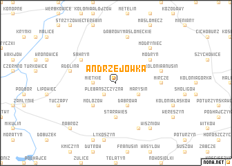
Andrzejówka (Poland)Andrzejówka is a town in Poland. An overview map of the region around Andrzejówka is displayed below.
regional and 3d topo map of Andrzejówka, Poland ::
Andrzejówka airports ::
The nearest airport is LWO - Lvov Lviv Intl, located 93.5 km south of Andrzejówka.
Other airports nearby include RZE - Rzeszow Jasionka (143.4 km south west), Nearby towns ::
Plebańszczyzna (2.2km south west) //
Miętkie (2.4km west) //
Dąbrowa (3.9km south) //
Marysin (3.0km south east) //
Mołożów (4.4km south west) //
Stara Wieś (5.6km south) //
Modryń (5.1km north east) //
Sahryń (5.1km north west) //
Mircze (4.7km east) //
Kolonia Ameryka (4.7km east) //
Dąbrowy Masłomęckie (7.5km north) //
Kolonia Anusin (5.1km east) //
Adelina (5.1km west) //
Modryniec (6.6km north east) //
Radostów (7.8km south) //
Wiszniów (8.2km south east) //
Nabróż (8.8km south west) //
[all distances 'as the bird flies' and approximate] 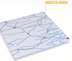 Places with similar names to Andrzejówka, Poland ::
Disclaimer :: Information on this page comes without warranty of any kind |
||
|
Where is Andrzejówka? Elevation and coordinates ::
Latitude (lat): 50°39'0"N Longitude (lon): 23°51'0"E
Elevation (approx.): 228m (map arrows pan, magnifying glasses zoom) |
||
|
Visiting Andrzejówka? Hotel/Accommodation ::
Book a hotel in Andrzejówka Travel Guide ::
Buy a travel guide for Poland rental cars ::
car rental offers GPS waypoint ::
download a GPX waypoint (PoI) of Andrzejówka for your GPS receiver
|
||