|
search place name
|
||
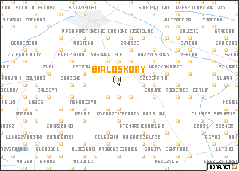
Białoskóry (Poland)Białoskóry is a town in Poland. An overview map of the region around Białoskóry is displayed below.
regional and 3d topo map of Białoskóry, Poland ::
Białoskóry airports ::
The nearest airport is WAW - Warsaw Okecie, located 109.0 km south east of Białoskóry.
Other airports nearby include GDN - Gdansk Lecha Walesy (197.0 km north west), Nearby towns ::
Kowalewo Boguszyce (1.9km south) //
Kowalewo (2.2km south west) //
Kowalewo Podborne (2.2km south east) //
Susk (3.7km north) //
Białyszewo Towarzystwo (2.2km east) //
Dębowo (2.2km east) //
Kowalewo Skorupki (3.7km south) //
Goleszyn (2.9km north east) //
Susk-Parcele (3.9km north) //
Puszcza (3.9km north) //
Grodkowo Włóki (3.9km north) //
Gozdowo (3.9km south) //
Kurówko (3.4km west) //
Szczepanki (3.4km east) //
Rycharcice Gnaty (5.6km south) //
Białyszewo (3.8km north east) //
Ostrowy (3.8km north west) //
Zawisze (5.7km north) //
Zbójno (3.8km south east) //
Warzyn Skóry (5.0km north east) //
Rękawczyn (5.0km south west) //
Smozewo (4.5km west) //
Budki (7.5km north) //
Borkowo Kościelne (7.5km north) //
Warzyn Kmiecy (4.9km east) //
Czachówko (7.5km south) //
Lisewo Duże (4.9km west) //
Piastowo (6.5km north west) //
Dziembakowo (6.5km north east) //
[all distances 'as the bird flies' and approximate]  Places with similar names to Białoskóry, Poland ::
Disclaimer :: Information on this page comes without warranty of any kind |
||
|
Where is Białoskóry? Elevation and coordinates ::
Latitude (lat): 52°46'0"N Longitude (lon): 19°42'0"E
Elevation (approx.): 122m (map arrows pan, magnifying glasses zoom) |
||
|
Visiting Białoskóry? Hotel/Accommodation ::
Book a hotel in Białoskóry Travel Guide ::
Buy a travel guide for Poland rental cars ::
car rental offers GPS waypoint ::
download a GPX waypoint (PoI) of Białoskóry for your GPS receiver
|
||