|
search place name
|
||
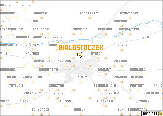
Białostoczek (Poland)Białostoczek is a town in Poland. An overview map of the region around Białostoczek is displayed below.
regional and 3d topo map of Białostoczek, Poland ::
Nearby towns ::
Antoniuk (1.1km west) //
Skorupy (2.2km south east) //
Białystok (2.2km south west) //
Dziesięciny (2.2km north west) //
Wygoda (2.2km east) //
Marczuk (2.9km south west) //
Usowicze (4.3km north west) //
Olmonty (5.6km south) //
Bagnówka (3.3km east) //
Sochonie (5.6km north) //
Jurowce (5.6km north) //
Kolonia Bacieczki (3.8km north west) //
Sielachowskie (5.7km north) //
Dojlidy (5.0km south east) //
Zawady (5.0km north west) //
Bacieczki (4.4km west) //
Zaścianki (4.8km south east) //
Hryniewicze (7.5km south) //
Wasilków (6.5km north east) //
Nowe Miasto (5.8km south west) //
Dojlidy Górne (7.7km south) //
Horodniany (8.1km south west) //
Stanisławowo (8.1km south east) //
Księżyno (8.1km south west) //
Leńce (7.1km north west) //
[all distances 'as the bird flies' and approximate]  Places with similar names to Białostoczek, Poland ::
// Białystoczek (PL)
Disclaimer :: Information on this page comes without warranty of any kind |
||
|
Where is Białostoczek? Elevation and coordinates ::
Latitude (lat): 53°9'0"N Longitude (lon): 23°10'0"E
Elevation (approx.): 136m (map arrows pan, magnifying glasses zoom) |
||
|
Visiting Białostoczek? Hotel/Accommodation ::
Book a hotel in Białostoczek Travel Guide ::
Buy a travel guide for Poland rental cars ::
car rental offers GPS waypoint ::
download a GPX waypoint (PoI) of Białostoczek for your GPS receiver
|
||