|
search place name
|
||
Borysów (Poland)Borysów is a town in Poland. An overview map of the region around Borysów is displayed below.
regional and 3d topo map of Borysów, Poland ::

Borysów airports ::
The nearest airport is KTW - Katowice Pyrzowice, located 157.0 km south of Borysów.
Other airports nearby include KRK - Krakow Balice (209.2 km south), Nearby towns ::
Poddębice (0.0km north) //
Zagórzyce (1.9km south) //
Praga (1.1km west) //
Rąkczyn (2.2km south east) //
Klementów (2.2km north west) //
Bałdrzychów (2.9km south west) //
Sworawa (2.9km north east) //
Małe (3.9km north) //
Bałdrzychowska Góra (4.4km south east) //
Kolonia Pudłów (5.6km south) //
Józefka (3.4km east) //
Łężki (3.4km east) //
Truskawiec (3.4km west) //
Kolonia Karnice (5.6km north) //
Chrapy (5.6km north) //
Karnice (5.7km north) //
Sędów (5.7km north) //
Pudłów (6.0km south) //
Pudłówek (6.0km south) //
Wólka (5.1km south east) //
Golice (5.1km north east) //
Nowa Wieś (4.6km west) //
Anusin (7.5km south) //
Wylazłów (4.9km west) //
Adamów (4.9km east) //
Tarnowa (4.9km east) //
Kolonia Spędoszyn (7.5km north) //
Wilczków (6.5km north west) //
Piotrów (7.8km south) //
[all distances 'as the bird flies' and approximate] 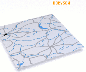 Places with similar names to Borysów, Poland ::
Disclaimer :: Information on this page comes without warranty of any kind |
||
|
Where is Borysów? Elevation and coordinates ::
Latitude (lat): 51°53'0"N Longitude (lon): 18°57'0"E
Elevation (approx.): 116m (map arrows pan, magnifying glasses zoom) |
||
|
Visiting Borysów? Hotel/Accommodation ::
Book a hotel in Borysów Travel Guide ::
Buy a travel guide for Poland rental cars ::
car rental offers GPS waypoint ::
download a GPX waypoint (PoI) of Borysów for your GPS receiver
|
||