|
search place name
|
||
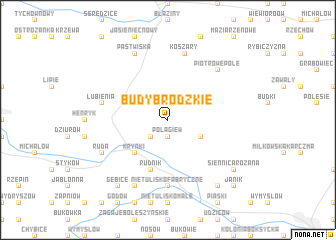
Budy Brodzkie (Poland)Budy Brodzkie is a town in Poland. An overview map of the region around Budy Brodzkie is displayed below.
regional and 3d topo map of Budy Brodzkie, Poland ::
Budy Brodzkie airports ::
The nearest airport is RZE - Rzeszow Jasionka, located 117.9 km south east of Budy Brodzkie.
Other airports nearby include WAW - Warsaw Okecie (125.7 km north), KRK - Krakow Balice (149.9 km south west), TAT - Poprad Tatry (231.4 km south), Nearby towns ::
Połągiew (1.9km south) //
Brody (2.2km south west) //
Bór Kunowski (3.0km south east) //
Krynki (4.4km south west) //
Rudnik (5.7km south) //
Nietulisko Fabryczne (7.4km south) //
Nietulisko (7.4km south) //
Lubienia (5.0km west) //
Koszary (7.5km north) //
Piotrowe Pole (6.6km north east) //
Ruda (6.0km south west) //
Doły Biskupie (7.8km south) //
Pastwiska (7.8km north) //
Siennica Różana (7.3km south east) //
Gębice (8.2km south west) //
Kolonia Inwalidzka (8.2km south east) //
Janik (8.8km south east) //
[all distances 'as the bird flies' and approximate] 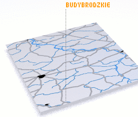 Places with similar names to Budy Brodzkie, Poland :: Disclaimer :: Information on this page comes without warranty of any kind |
||
|
Where is Budy Brodzkie? Elevation and coordinates ::
Latitude (lat): 51°3'0"N Longitude (lon): 21°15'0"E
Elevation (approx.): 241m (map arrows pan, magnifying glasses zoom) |
||
|
Visiting Budy Brodzkie? Hotel/Accommodation ::
Book a hotel in Budy Brodzkie Travel Guide ::
Buy a travel guide for Poland rental cars ::
car rental offers GPS waypoint ::
download a GPX waypoint (PoI) of Budy Brodzkie for your GPS receiver
|
||