|
search place name
|
||
Charbowo (Poland)Charbowo is a town in Poland. An overview map of the region around Charbowo is displayed below.
regional and 3d topo map of Charbowo, Poland ::

Charbowo airports ::
The nearest airport is POZ - Poznan Lawica, located 48.5 km south west of Charbowo.
Other airports nearby include IEG - Zielona Gora Babimost (124.8 km south west), WRO - Wroclaw Strachowice (177.8 km south), OSP - Slupsk Redzikowo (202.7 km north), GDN - Gdansk Lecha Walesy (202.7 km north), Nearby towns ::
Ułanowo (0.0km north) //
Świniary (2.2km north east) //
Polska Wieś (3.7km south) //
Kłecko (3.9km south) //
Jaworówko (4.3km north west) //
Kłodzin (4.3km north west) //
Wilkowyja (4.3km south west) //
Gołka (5.7km north) //
Borzątew (3.8km south east) //
Strzeszkowo (6.0km north) //
Czechy (7.4km south) //
Michalcza (4.5km west) //
Piastowice (7.5km north) //
Gorzewo (7.7km north) //
Karniszewo (5.8km south east) //
Kamieniec (5.8km south west) //
Miłosławice (8.1km north west) //
Mieścisko Ulica (8.1km north west) //
Florentynowo (7.2km south east) //
Łopienno (7.1km north east) //
Biskupice Jeziorne (7.2km south east) //
Olekszyn (7.2km south west) //
[all distances 'as the bird flies' and approximate] 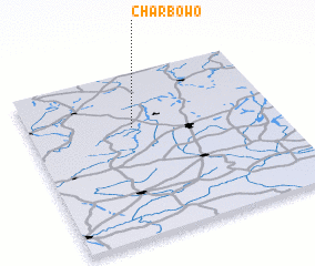 Places with similar names to Charbowo, Poland ::
// Charabawi (KR)
Disclaimer :: Information on this page comes without warranty of any kind |
||
|
Where is Charbowo? Elevation and coordinates ::
Latitude (lat): 52°40'0"N Longitude (lon): 17°25'0"E
Elevation (approx.): 122m (map arrows pan, magnifying glasses zoom) |
||
|
Visiting Charbowo? Hotel/Accommodation ::
Book a hotel in Charbowo Travel Guide ::
Buy a travel guide for Poland rental cars ::
car rental offers GPS waypoint ::
download a GPX waypoint (PoI) of Charbowo for your GPS receiver
|
||