|
search place name
|
||
Chomentów (Poland)Chomentów is a town in Poland. An overview map of the region around Chomentów is displayed below.
regional and 3d topo map of Chomentów, Poland ::

Chomentów airports ::
The nearest airport is KRK - Krakow Balice, located 83.7 km south west of Chomentów.
Other airports nearby include KTW - Katowice Pyrzowice (104.0 km west), RZE - Rzeszow Jasionka (123.5 km south east), WAW - Warsaw Okecie (169.7 km north), TAT - Poprad Tatry (178.3 km south), Nearby towns ::
Korytnica (0.0km north) //
Niziny (2.2km north west) //
Karsy (2.3km east) //
Jawor (3.0km north east) //
Wierzbica (3.9km north) //
Borczyn (3.9km south) //
Kliszów (3.9km south) //
Rębów (3.9km south) //
Chmielowice (4.4km north east) //
Wierzbica Dworska (4.4km north west) //
Staniewice (4.4km north west) //
Michalinówka (5.6km north) //
Lipa (3.5km east) //
Sobków (5.1km north west) //
Kawczyn (5.1km north east) //
Borszowice (6.0km south west) //
Łukowa (7.5km north) //
Obice (5.1km east) //
Kotlice (5.1km west) //
Drochów Górny (6.0km north east) //
Drochów Dolny (6.0km north east) //
Wierzbica (6.0km south east) //
Hajdaszek (7.8km south) //
Kokot (7.8km south) //
Motkowice (7.8km south) //
Kolonia Sokołów (8.2km north west) //
Kije (7.3km south east) //
Górki (7.3km south east) //
Zbrza (8.8km north east) //
[all distances 'as the bird flies' and approximate] 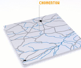 Places with similar names to Chomentów, Poland ::
Disclaimer :: Information on this page comes without warranty of any kind |
||
|
Where is Chomentów? Elevation and coordinates ::
Latitude (lat): 50°40'0"N Longitude (lon): 20°31'0"E
Elevation (approx.): 267m (map arrows pan, magnifying glasses zoom) |
||
|
Visiting Chomentów? Hotel/Accommodation ::
Book a hotel in Chomentów Travel Guide ::
Buy a travel guide for Poland rental cars ::
car rental offers GPS waypoint ::
download a GPX waypoint (PoI) of Chomentów for your GPS receiver
|
||