|
search place name
|
||
Cisów (Poland)Cisów is a town in Poland. An overview map of the region around Cisów is displayed below.
regional and 3d topo map of Cisów, Poland ::
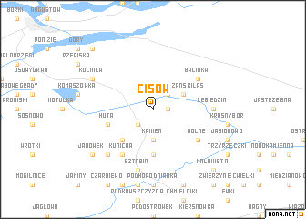
Nearby towns ::
Kryłatka (1.1km east) //
Długie (2.2km north east) //
Podcisówek (2.2km south west) //
Kamień (3.7km south) //
Dłużański Las (2.9km north east) //
Fedorowizna (4.3km south west) //
Krasnoborki (5.6km south) //
Huta (3.8km south west) //
Balinka (5.0km north east) //
Wolne (5.0km south east) //
Ewy (6.0km south) //
Kunicha (6.0km south) //
Lebiedzin (4.4km east) //
Sztabin (7.5km south) //
Katolin (6.5km south west) //
Kolnica (5.7km north west) //
Janówek (7.1km south west) //
Małowista (8.6km south east) //
Czarnucha (8.6km north west) //
[all distances 'as the bird flies' and approximate] 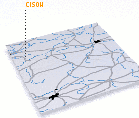 Places with similar names to Cisów, Poland ::
Disclaimer :: Information on this page comes without warranty of any kind |
||
|
Where is Cisów? Elevation and coordinates ::
Latitude (lat): 53°45'0"N Longitude (lon): 23°7'0"E
Elevation (approx.): 150m (map arrows pan, magnifying glasses zoom) |
||
|
Visiting Cisów? Hotel/Accommodation ::
Book a hotel in Cisów Travel Guide ::
Buy a travel guide for Poland rental cars ::
car rental offers GPS waypoint ::
download a GPX waypoint (PoI) of Cisów for your GPS receiver
|
||