|
search place name
|
||
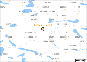
Czapiewice (Poland)Czapiewice is a town in Poland. An overview map of the region around Czapiewice is displayed below.
regional and 3d topo map of Czapiewice, Poland ::
Czapiewice airports ::
The nearest airport is GDN - Gdansk Lecha Walesy, located 72.4 km north east of Czapiewice.
Other airports nearby include OSP - Slupsk Redzikowo (73.0 km north west), POZ - Poznan Lawica (176.0 km south), IEG - Zielona Gora Babimost (234.8 km south west), Nearby towns ::
Czarnowo (2.2km south east) //
Bingerstwo (3.9km south) //
Kaszuba (4.3km north west) //
Leśno (4.3km north east) //
Brusy (4.3km south east) //
Czyczkowy (5.6km south) //
Zalesie (3.8km north east) //
Małe Chełmy (3.8km south west) //
Antoniewo (3.8km south west) //
Parzyn (6.0km north) //
Żabno (6.0km south) //
Wielkie Chełmy (4.9km south west) //
Wysoka Zaborska (7.5km north) //
Orlik (6.5km north east) //
Windorf (7.7km north) //
Kinice (5.7km south east) //
Główczewice (8.1km north east) //
[all distances 'as the bird flies' and approximate] 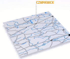 Places with similar names to Czapiewice, Poland :: Disclaimer :: Information on this page comes without warranty of any kind |
||
|
Where is Czapiewice? Elevation and coordinates ::
Latitude (lat): 53°55'0"N Longitude (lon): 17°41'0"E
Elevation (approx.): 145m (map arrows pan, magnifying glasses zoom) |
||
|
Visiting Czapiewice? Hotel/Accommodation ::
Book a hotel in Czapiewice Travel Guide ::
Buy a travel guide for Poland rental cars ::
car rental offers GPS waypoint ::
download a GPX waypoint (PoI) of Czapiewice for your GPS receiver
|
||