|
search place name
|
||
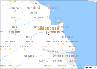
Dębogórze (Poland)Dębogórze is a town in Poland. An overview map of the region around Dębogórze is displayed below.
regional and 3d topo map of Dębogórze, Poland ::
Dębogórze airports ::
The nearest airport is GDN - Gdansk Lecha Walesy, located 24.8 km south of Dębogórze.
Other airports nearby include OSP - Slupsk Redzikowo (89.0 km west), Nearby towns ::
Mosty (2.1km north east) //
Kosakowo (2.1km south east) //
Pierwoszyno (2.1km east) //
Dobki (3.7km south) //
Kazimierz (2.8km north west) //
Rewa (4.3km north east) //
Pogórze (4.3km south east) //
Mechelinki (3.7km north east) //
Cisowa (5.7km south) //
Beka (6.0km north) //
Obłuże (4.9km south east) //
Mrzezino (6.0km north) //
Babie Doły (4.7km south east) //
Chylonia (7.5km south) //
Rumia (4.7km south west) //
Zagórze (5.7km south west) //
Smolno (8.1km north west) //
[all distances 'as the bird flies' and approximate]  Places with similar names to Dębogórze, Poland ::
// Tabaqueros (ES)
// Dabak Kārez (PK)
Disclaimer :: Information on this page comes without warranty of any kind |
||
|
Where is Dębogórze? Elevation and coordinates ::
Latitude (lat): 54°36'0"N Longitude (lon): 18°28'0"E
Elevation (approx.): 40m (map arrows pan, magnifying glasses zoom) |
||
|
Visiting Dębogórze? Hotel/Accommodation ::
Book a hotel in Dębogórze Travel Guide ::
Buy a travel guide for Poland rental cars ::
car rental offers GPS waypoint ::
download a GPX waypoint (PoI) of Dębogórze for your GPS receiver
|
||