|
search place name
|
||
Dębowa Góra (Poland)Dębowa Góra is a town in Poland. An overview map of the region around Dębowa Góra is displayed below.
regional and 3d topo map of Dębowa Góra, Poland ::

Dębowa Góra airports ::
The nearest airport is WAW - Warsaw Okecie, located 74.0 km north east of Dębowa Góra.
Other airports nearby include KTW - Katowice Pyrzowice (157.1 km south west), KRK - Krakow Balice (173.1 km south), RZE - Rzeszow Jasionka (194.2 km south east), Nearby towns ::
Różanna (1.9km north) //
Stanisławów (1.2km west) //
Gilówka (3.0km north east) //
Myślakowice (3.9km north) //
Kamienna Wola (4.4km south east) //
Dąbrowa (3.9km north west) //
Prosna (3.9km north east) //
Ossa (5.7km south) //
Walerianów (6.0km south west) //
Łęgonice Małe (6.0km north) //
Łęgonice (6.0km north) //
Odrzywół (5.1km south east) //
Bieliny (7.4km north) //
Żdżarki (5.0km east) //
Domaszno (7.5km south) //
Brudzewice (5.0km west) //
Kobuz (6.5km north west) //
Domaniewice (7.8km north) //
Kłonna (7.8km south) //
Ceteń (5.9km south east) //
Wysokin (5.9km south east) //
Góra (7.2km north east) //
[all distances 'as the bird flies' and approximate] 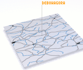 Places with similar names to Dębowa Góra, Poland ::
Disclaimer :: Information on this page comes without warranty of any kind |
||
|
Where is Dębowa Góra? Elevation and coordinates ::
Latitude (lat): 51°34'0"N Longitude (lon): 20°30'0"E
Elevation (approx.): 160m (map arrows pan, magnifying glasses zoom) |
||
|
Visiting Dębowa Góra? Hotel/Accommodation ::
Book a hotel in Dębowa Góra Travel Guide ::
Buy a travel guide for Poland rental cars ::
car rental offers GPS waypoint ::
download a GPX waypoint (PoI) of Dębowa Góra for your GPS receiver
|
||