|
search place name
|
||
Dryga (Poland)Dryga is a town in Poland. An overview map of the region around Dryga is displayed below.
regional and 3d topo map of Dryga, Poland ::

Nearby towns ::
Stara Chodorówka (1.1km west) //
Trzyrzecze (2.2km west) //
Skindzierz (2.9km south west) //
Krzywa (3.9km north) //
Dubasiewszczyzna (2.9km north east) //
Nowe Stojło (3.3km east) //
Wyłudy (5.7km south) //
Suchowola (6.0km north) //
Zagórze (6.0km south) //
Wysokie (6.0km south) //
Wyłudki (6.0km south) //
Zabrodzie (7.5km south) //
Kizielany (4.8km south east) //
Głęboczyzna (7.5km north) //
Wólka (4.8km north east) //
Brukowo (6.5km north east) //
Laskowszczyzna (6.5km south east) //
Franckowa Buda (6.5km south east) //
Kumiała (7.7km south) //
Jasionowa Dolina (7.1km south east) //
[all distances 'as the bird flies' and approximate] 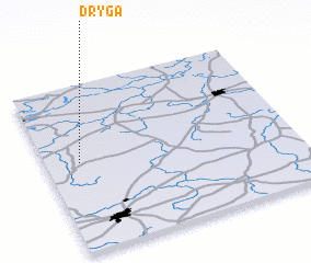 Places with similar names to Dryga, Poland ::
Disclaimer :: Information on this page comes without warranty of any kind |
||
|
Where is Dryga? Elevation and coordinates ::
Latitude (lat): 53°32'0"N Longitude (lon): 23°8'0"E
Elevation (approx.): 145m (map arrows pan, magnifying glasses zoom) |
||
|
Visiting Dryga? Hotel/Accommodation ::
Book a hotel in Dryga Travel Guide ::
Buy a travel guide for Poland rental cars ::
car rental offers GPS waypoint ::
download a GPX waypoint (PoI) of Dryga for your GPS receiver
|
||