|
search place name
|
||
Duranów (Poland)Duranów is a town in Poland. An overview map of the region around Duranów is displayed below.
regional and 3d topo map of Duranów, Poland ::

Duranów airports ::
The nearest airport is WAW - Warsaw Okecie, located 49.2 km east of Duranów.
Other airports nearby include KTW - Katowice Pyrzowice (208.6 km south west), Nearby towns ::
Rokotów (1.9km south) //
Boryszew (2.2km north west) //
Sielice (2.2km south east) //
Białymin (2.2km south east) //
Sochaczew (3.7km north) //
Trojanów (3.7km north) //
Gradów (3.7km south) //
Bielice (2.9km south east) //
Orłów (3.9km south) //
Białymin Nowy (4.3km south east) //
Leonów (4.3km south west) //
Gawłów (5.6km north) //
Kozłów Biskupi (3.4km west) //
Nowa Wieś (5.7km north) //
Dachowa (3.9km north west) //
Jeżówka (5.0km south east) //
Kazimierzów (4.5km east) //
Helenka (7.4km north) //
Żuków (7.5km north) //
Sucha Nowa (6.5km south west) //
Feliksów (5.9km north east) //
Adamowa Góra (7.8km north) //
Żylin Nowy (5.9km south west) //
Mostki Nowe (7.2km north east) //
Antoniew Żdżarów (7.2km north west) //
Chodaków (8.2km north east) //
Zwierzyniec (8.2km north east) //
Żylin Stary (7.2km south west) //
Sucha Stara (7.2km south west) //
[all distances 'as the bird flies' and approximate] 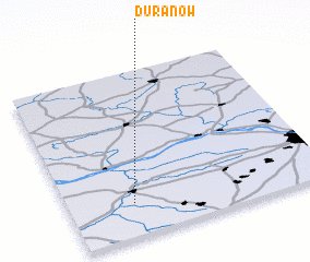 Places with similar names to Duranów, Poland ::
Disclaimer :: Information on this page comes without warranty of any kind |
||
|
Where is Duranów? Elevation and coordinates ::
Latitude (lat): 52°12'0"N Longitude (lon): 20°15'0"E
Elevation (approx.): 82m (map arrows pan, magnifying glasses zoom) |
||
|
Visiting Duranów? Hotel/Accommodation ::
Book a hotel in Duranów Travel Guide ::
Buy a travel guide for Poland rental cars ::
car rental offers GPS waypoint ::
download a GPX waypoint (PoI) of Duranów for your GPS receiver
|
||