|
search place name
|
||
Gierniak (Poland)Gierniak is a town in Poland. An overview map of the region around Gierniak is displayed below.
regional and 3d topo map of Gierniak, Poland ::

Gierniak airports ::
The nearest airport is RZE - Rzeszow Jasionka, located 108.0 km south west of Gierniak.
Other airports nearby include LWO - Lvov Lviv Intl (158.6 km south east), WAW - Warsaw Okecie (177.4 km north west), Nearby towns ::
Giełczew (1.9km south) //
Teklin (1.2km west) //
Kosarzew Górny (2.3km west) //
Borzęcinek (2.3km east) //
Boży Dar (3.9km north) //
Zielona (3.9km north) //
Krzczonów-Wójtostwo (3.0km north east) //
Doły (4.4km south east) //
Krzczonów Trzeci (3.5km east) //
Majdan Piotrków (5.7km north) //
Olszanka (5.7km north) //
Lewandowszczyzna (5.1km north west) //
Kosarzew (4.7km west) //
Kosarzew Dolny (4.7km west) //
Piotrkówek (7.4km north) //
Wysokie (7.5km south) //
Urszulin (5.0km west) //
Biesiadki (6.0km north west) //
Słupeczno (8.2km south east) //
Piotrków (8.2km north west) //
Tarnawka (8.8km south west) //
Antoniówka (8.8km south east) //
[all distances 'as the bird flies' and approximate] 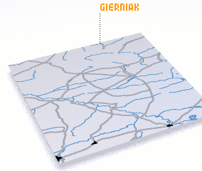 Places with similar names to Gierniak, Poland ::
// Giornico (CH)
// Giering (AT)
// Giering (AT)
// Jauernig (AT)
// Jauring (AT)
// Gehring (DE)
// Gehring (DE)
// Geiering (DE)
// Jareniówka (PL)
// Jereniówka (PL)
Disclaimer :: Information on this page comes without warranty of any kind |
||
|
Where is Gierniak? Elevation and coordinates ::
Latitude (lat): 50°59'0"N Longitude (lon): 22°41'0"E
Elevation (approx.): 274m (map arrows pan, magnifying glasses zoom) |
||
|
Visiting Gierniak? Hotel/Accommodation ::
Book a hotel in Gierniak Travel Guide ::
Buy a travel guide for Poland rental cars ::
car rental offers GPS waypoint ::
download a GPX waypoint (PoI) of Gierniak for your GPS receiver
|
||